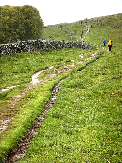
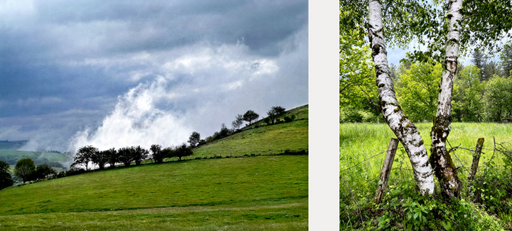
This photograph summarizes our walk on the Chemin: wet weather, muddy terrain, and a whole lotta green.
From Le-Puy-en-Velay to Conques In May we returned to the Lozère-Aveyron area to walk the second half of the section of the Chemin de Saint-Jacques that we had begun in June of 2022. You can read about the beginning of the adventure here and here.
A refresher: my friend Claude had long wanted to walk from Le-Puy-en-Velay to Conques. Many French people consider this to be the prettiest section of the Chemin in all of France, which is saying a lot. Take a look at the black and grey map below to see how France is covered with variations of Chemin routes, nearly all of them converging in Saint-Jean-Pied-de-Port.
Look at it this way: from almost anywhere in Europe outside of Spain, a pilgrim had to walk through France to get to Compostela in Spain. Le Puy is also special because it was the starting point for the very first pilgrimage to Compostela from a location outside of Spain; it was walked in around 950 AD by a fellow named Bishop Godescalc. This route is also called the Via Podiensis.
Last year, we missed the last étape (stage) due to blisters, so this year we started very near where we stopped last year, in a hamlet named Prinsuéjols, part of Malbouzon. Here’s the map that I included last year, showing our full route:
Here’s our full route, one section of the GR 65, part of France’s Grande Randonnée network. We walked the first part in June 2022, from Le-Puy-en-Velay to Malbouzon (not on the map, but just east of Nasbinals). In May 2023, we walked from Prinsuéjols—a hamlet near Malbouzon—to Conques. I found this map on this website: Saint-Jacques-un-coeur-neuf.
In Estaing we found intriguing info boards about the Chemin. Above is a map of France, showing the four major French routes of the Chemin de Saint-Jacques, along with some of the bigger feeder routes. Below is an impressive map showing the extent of the routes to the three major Christian pilgrimage sites: Jerusalem, Rome and Compostela.
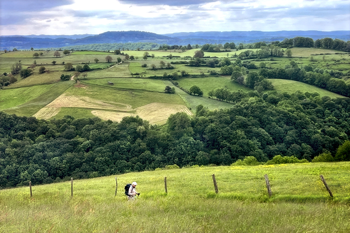
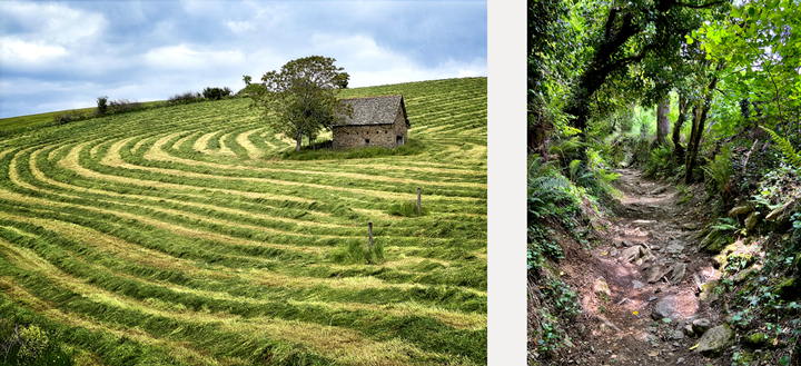
Getting started Last year we walked in June, and after a tranquil first few days, the weather turned hot and dry. For this year’s section, we decided to go a month earlier, and had cooler, wetter weather. The visual theme of our walk was green, ever so many shades of green. In some places, it was a screaming neon green of remarkable intensity, while in other places it was the deep, calming green of a peaceful forest.
We had such an abundance of wildflowers that I’ve chosen to group all of the flower photographs into a separate post, which I’ll send soon. It was magical.
We also made an important tweak to the way we scheduled our stages: between age and the desire to be tourists as well as pilgrims, we chose to make the stages shorter. This turned out to be a good thing all around, with the desirable bonus that there were no blisters to stop our walking.
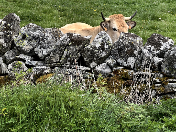
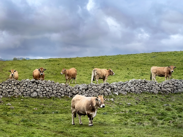
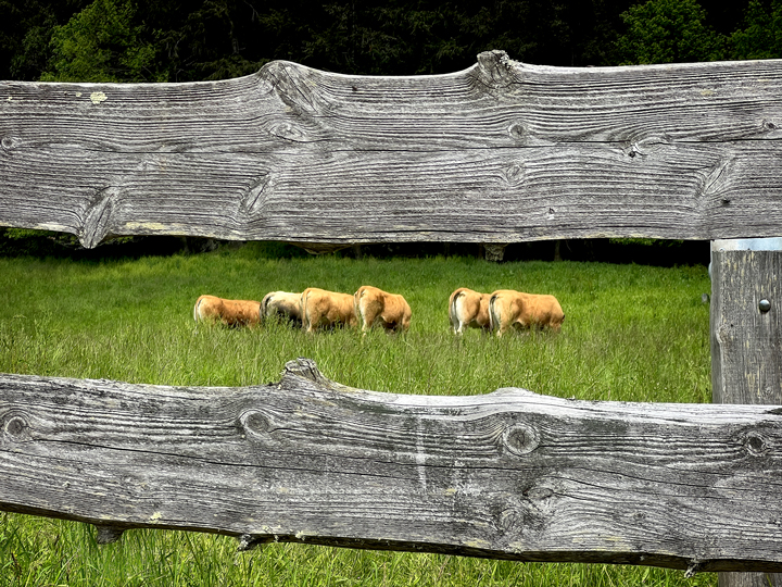
The Aubrac region has grassy, rolling hills and a lot of rocks…
… So many rocks that the fertile land is less suited to crops and much better for grazing cattle. This region is home to the lovely Aubrac cattle.
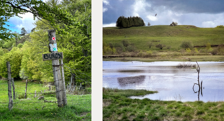
With cattle come steak and cheese, and both products from Aubrac are renowned around France. A buron (sign in left photo) is a large hut, often built into a hillside, that was used during summer months as a working base camp for milking cattle and making cheese. These operations have almost entirely moved to more modern facilities, so many of the old burons are now restaurants serving traditional Aubrac fare, especially aligot, a bit of French soul food. Aligot is made by combining finely mashed potatoes with cream, butter, and a surprisingly large quantity of fresh local Cantal cheese.
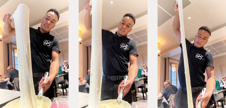
Our server Adri demonstrates the technique of serving up a portion of cheesy aligot.
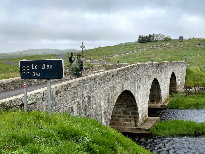
Claude in his rain poncho, waving from the 16th-century Pont de Marchastel. The Bès river in this area has the rare feature of river banks that are formed of peat bogs (tourbières in French).
Our first day of walking dawned cool and grey, with the dark sky feeling so low that we thought we could reach up to touch it. The rain came soon enough, and we all shimmied into our rain ponchos, designed to go over full backpacks.
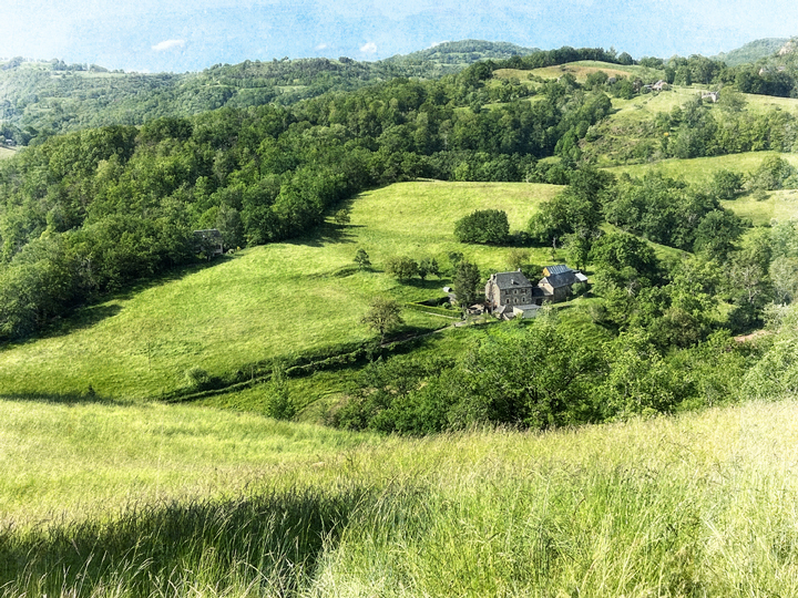
Our walk from Prinsuéjols to Nasbinals took us through a couple of small hamlets, but mostly it was a walk through lush green terrain made quiet by overcast skies.
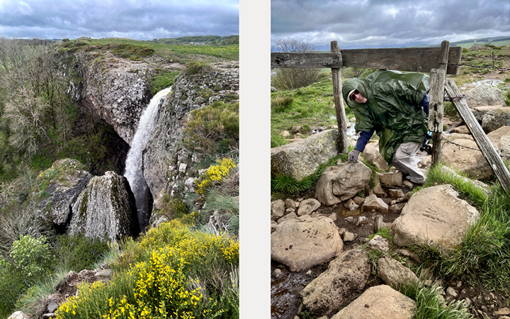
Claude wanted to see the Cascade du Déroc, which was worth the climb and detour. By the time we got there, the rain had eased into a sporadic fine mist.
Left, the top part of the Cascade du Déroc, a fresh surprise in the lush green hills. It’s 33 meters tall, about 108 feet. Right, the terrain leading to the waterfall was a little tricky to navigate, as there was a great deal of mud, a lot of rocks, and barbed wire fences to duck through.
There’s something about this scene that makes me laugh every time I look at it. I named it “Outcast.” This was along a very pretty stone-lined track that took us into Nasbinals and our stop for the night.
In Nasbinals, we ended up staying in the same hotel where we ended last year’s walk. It’s the Hotel de France, and spending a night there felt like coming home. The staff are friendly, welcoming, and easy to talk to. The rooms are nicely modern and well-appointed, and best of all, the bar/restaurant is bursting with locals. It’s a cheerful and lively place, and I’d gladly return.
The next day dawned grey and misty, and I was just fine with that. I learned on this walk that if I’m wearing the right gear, walking in the rain can be a blissful bit of quiet in a busy world. This day would prove to be our wettest, but it was also one of our shortest.
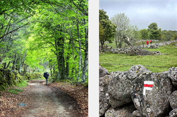
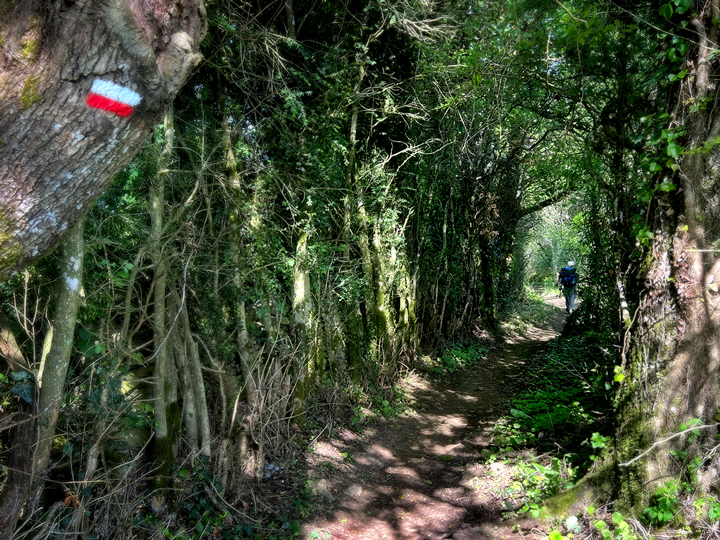
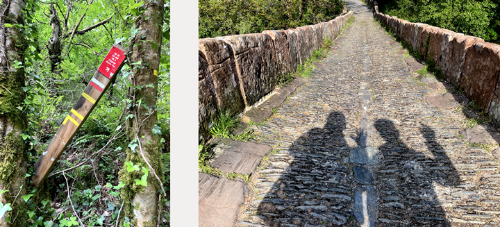
Left, Claude makes a photo in a lush green forest early in the day’s walk. Right: the white-and-red blaze of the GR65 (Chemin de Compostelle), and just behind that, two red-clad pilgrims on the trail.
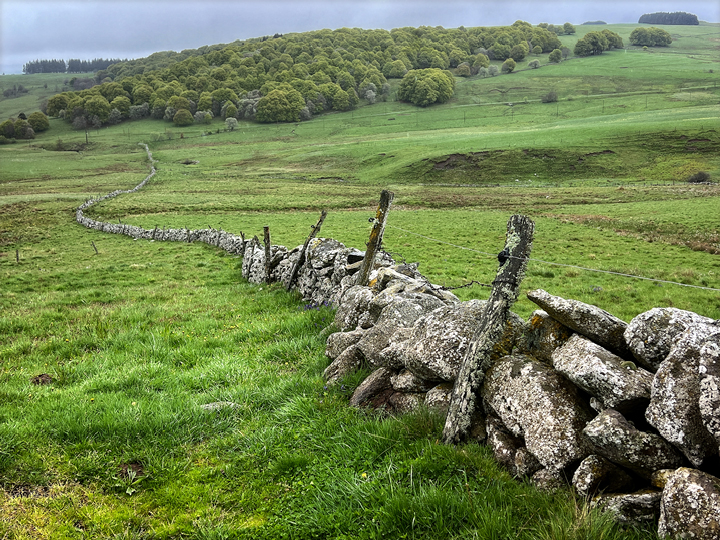
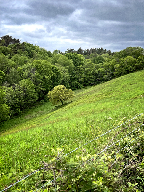
After the forest, we came out onto a high plateau with expansive vistas of—wait for it—grey skies and verdant fields dotted with rocks.
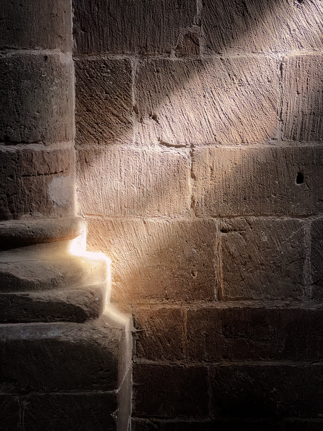
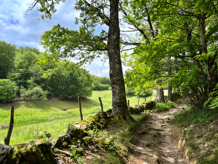
We walked briefly through a forest of magnificent beech trees, whose roots are a world unto themselves. This is where I made the photo at the top of this post.
A long push up a soggy hill before we descended into Aubrac, our stop for the night. One of our shortest walks of this section of the route, this was also the wettest and muddiest. And utterly glorious.
Another of our favorite finds on this journey was a restaurant called L’Annexe d’Aubrac in the hamlet of Aubrac. Quite a number of wet, muddy and tired pilgrims found their way to this delightful haven; just inside the door was a sodden pile of jackets, ponchos, backpacks and walking poles. Bedraggled souls found tables near a giant wood-burning stove, and placed boots around it to dry out. The restaurant’s decor is a delicious mélange that is both sparkly and woodsy, the perfect incarnation of Artemis herself. There are various animal skulls mixed in with fairy lights and feathers. There are beads and antique mirrors, leather couches and bronze sculptures. There is a magnificent dog that is 3/4 wolf. I adored it, and because we couldn’t check in to our accommodation until later in the day, we passed a good while in this magical place.
We awoke to a morning that was wet in every way possible except that it wasn’t raining. It was impressive. This was the scene as we departed Aubrac about 9:00 a.m.
The next morning brought us a sky heavily laden with moisture without actually raining. It made for a dark and very quiet start to our walk for the day. Despite the muddy trail, we passed through some lovely terrain on our way to Saint-Chély-d’Aubrac.
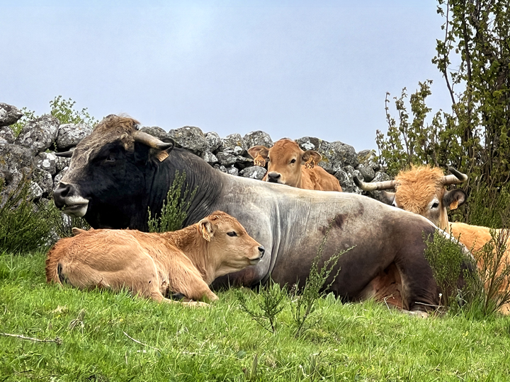
Here’s a sight we don’t usually see in the United States: a calf nestled up against its papa bull, a rather grand fellow.
We passed through the hamlet of Belvezet, where we saw this home-made waymarker for the Chemin, plus a fine stone barn with a gorgeous door frame.
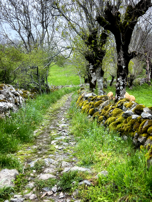
A pretty place for a walk.
In Saint-Chély-d’Aubrac, we found more stone buildings with fascinating doors and windows. These two are a bit more fanciful and playful.
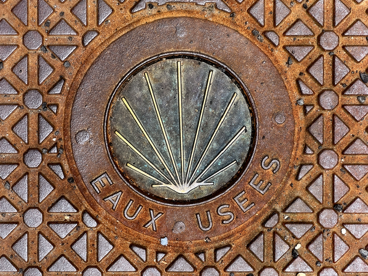
An attractive manhole cover that incorporates the shell of Saint James. It’s a sewage drain, but the literal translation of the phrase is “used water,” which cracks me up.
While I was photographing the manhole cover above, this friendly cat plopped down and rolled over to invite me to give him some belly rubs. I declined, but he followed us as we explored his neighborhood, and he did get a lot of not-on-the-belly caresses.
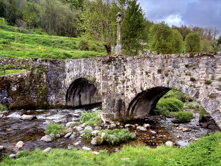
The Pont des Pèlerins in Saint-Chély-d’Aubrac dates to the 14th century; the cross in the center is made of basalt and is about 100 years newer.
We awoke the next morning to see a weak sun working valiantly to burn off a light mist, and by the time we left after breakfast, there was blue sky and sunshine. We descended along the medieval street where the weavers used to live and work, and made our way across the 14th-century stone bridge crossing the Boralde River. It’s hard to see in the photograph above, but the bridge is built on a slope, with the side on the opposite bank being noticeably higher, and the opposite arch is also a good deal wider than the nearer one.
We climbed out of the village and worked our way up to a magnificent beech forest. It felt like we’d entered an enchanted land where the air itself was neon green.
The air itself seemed vivid green in this remarkable beech forest.
A little further along, we climbed onto a hilly plateau, where mists were swirling and some clouds started appearing. Everywhere we turned there seemed to be a new shade of green
I love the handmade signs showing us which direction to go. This one includes the name of our destination for the day, Saint-Côme-d’Olt, plus the shell of Saint James and the white and red blaze of the GR65. Shortly after this, the clouds grew more dense and we began to see lightning; we were caught in a downpour as we approached Saint-Côme.
We had arrived in Saint-Côme-d’Olt in heavy rain on a Sunday afternoon; it was too early to check in to our bed and breakfast, and everything in the village was closed. Besides being wet, we hadn’t had lunch, so we were both feeling a bit desperate when we asked a young couple if they knew where our inn was. It turned out that I had the wrong name, which confused them momentarily until one of them suggested maybe it was the house right in front of us. Indeed it was, and this couple were our hosts, just leaving for the afternoon. When they realized our bedraggled condition, they promptly opened the door and invited us in, even offering to dry our boots for us.
Our home for the night was Au Pont d’Olt, a 400-year-old stone house near the bridge over the Lot River. (In the eastern part of this river valley, the Lot River is often referred to by its much older name, the Olt.) It was a real pleasure to stay here, from the warm welcome to the delicious dinner to the down comforter on the perfect bed. I’d go back to the region just to stay with Alex and Cintia again.
Across from our chambres-d’hôtes was this this charming old stone house with a fascinating roof.
That was a blissful night’s sleep! We arose to a yummy breakfast before setting out on a foggy morning, headed along the river toward Espalion.
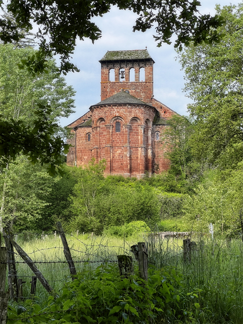
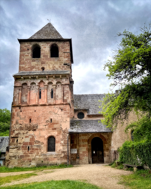
The route took us right to the marvelous Église de Perse on the outskirts of Espalion. (The full name is Église Saint-Hilarian-Sainte-Foy de Perse.) We had visited this church on a road trip two years ago, but we were both eager to see it again. Built in the late 11th century of red sandstone, it includes some remarkable medieval sculpture, namely, the tympanum over the main portal, a full array of corbels (modillons in French), and several beautiful column capitals.
The beautiful Église de Perse in Espalion.
The remarkable tympanum illustrating Pentecost: the Virgin Mary receives the Holy Spirit in the form of a dove, while tongues of fire are directed towards the apostles.
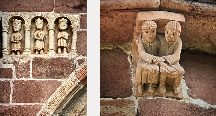
Left, above the tympanum are the three Magi. Right: a couple holding hands forms one of the beautifully-carved corbels that parade around the exterior of the church.
A shaft of sunlight on an interior wall of the Église de Perse in Espalion.
We continued our walk into the center of Espalion, finding a nice spot for lunch in the sunshine of an outdoor café. We ended up sharing a table with the couple who had stayed at the same chambres-d’hôtes the night before, and then our host Alex arrived to have lunch with work colleagues. We felt right at home.
Le Pont Vieux (the Old Bridge) in Espalion. The first bridge here was built in the 10th century, and there were several modifications until the current version was completed in the 16th century.
Espalion was our choice for taking a rest day. It’s a big enough place that there’s a selection of cafés and restaurants, the all-important laundromat, a visitor center, and plenty to see. There’s also a splendid bookstore here, Librairie Pont Virgule, right at the end of the old bridge.
We arrived early enough in the day that we were able to see much of the old center of Espalion that afternoon. The next morning after breakfast, we hauled our laundry to a recommended laundromat, and once that task was done, we headed off to the delightful Église Saint-Pierre in the nearby hamlet of Bessuéjouls. This is another Romanesque church that we had seen two years ago, but that didn’t dampen our enthusiasm for seeing it again.
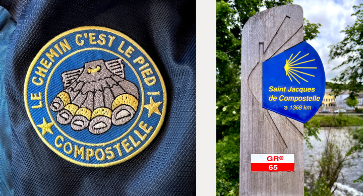
The patch on Claude’s backpack is a funny riff on the shell of Saint James (la coquille Saint Jacques) that is the symbol of the Chemin de Compostelle.
The Église Saint-Pierre in Bessuéjouls is a fine example of art and architecture dating to the style transition from Carolingian to Romanesque. The bell tower on the left dates to the 10th century, and contains an intact second-story chapel (in the center, where there are two very narrow windows). It was a Carolingian design to place the chapel above the porch, a style also seen in the much larger 10th-century church in Conques. The visitor climbs a steep, narrow stone stairway, coming out into a space that is almost perfectly preserved and of museum quality. In the 16th century, the church was enlarged (to the right in the photo), but I’m grateful that instead of destroying the earlier structure, as was commonly done, they completely preserved it, giving generations of us the rare opportunity to see it in roughly its original form.
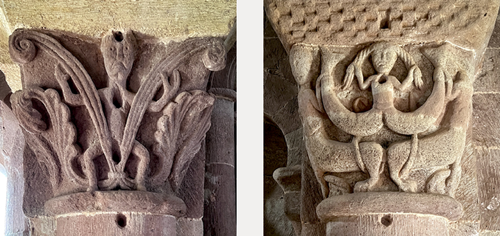
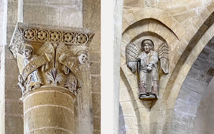
Taking a look at column capitals in the Chapelle Saint-Michel of the Église Saint-Pierre in Bessuéjouls. At the right is a view of one end of the rare and exquisite 11th-12th-century altar; the image is possibly Saint Gabriel, holding a phylactery.
The chapel is full of wonderful stone carving. Many of the designs include ornate interlacing, a style popular in Carolingian art and architecture; we also see animals, humans, plants, and angels. The two capitals above stand across from each other. On the left is an atlas figure. On the right is a design copied from the church in Conques: two centaurs lean against each other, their backs supporting a double-tailed mermaid.
Click here for a great source of information about the Église Saint-Pierre (in French).
From Espalion we were headed just across the river to Estaing, although the walking route did some serious meandering. On our first truly sunny day, we walked past Bessuéjouls and then made a pretty steep climb up to a farming plateau. The wind got feisty here, which made mesmerizing, sinewy patterns in the waving grass. The red poppies came out to play, too.
A multiple-exposure of poppies and grasses waving in strong wind.
We walked through a forest and then had a long, slippery descent through deep mud, arriving back into the open sunshine at the Église de Trédou. Along with many other pilgrims, we paused for a break before continuing our descent into a broad, flat farming valley. We found a nice outdoor spot for lunch and then continued to the charming hamlet of Verrières, where we found a funky little church. Another climb and descent took us into Estaing, our stop for the night.
Claude walks ahead of me on a quiet forest trail.
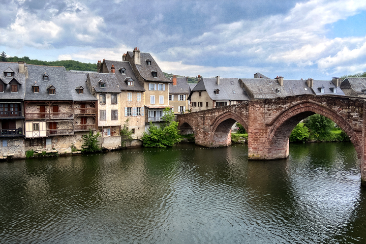
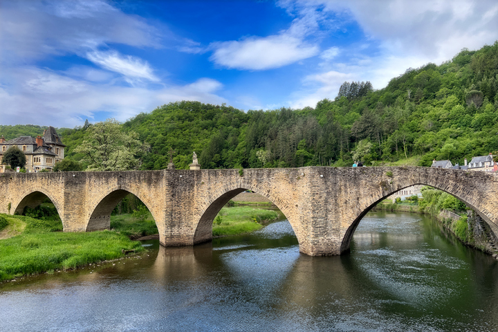
The lovely 16th-century bridge in Estaing, which doesn’t seem to have a name and is referred to simply as “the bridge on the Lot” [River].
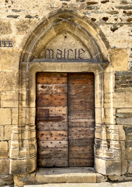
How many towns have an entrance to their city hall (mairie in French) that looks like this? It’s housed in the 16th-century Hôtel de Cayron.
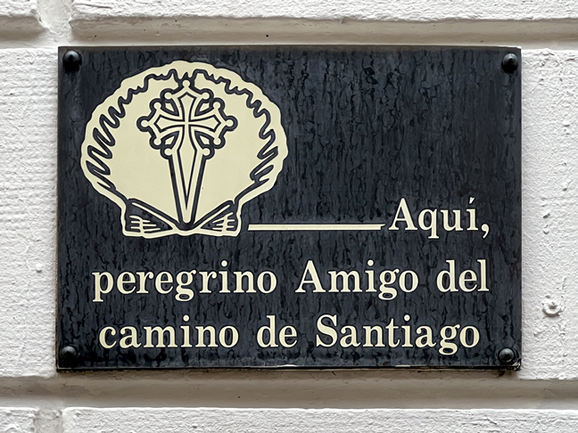
“Here, a friend to the pilgrim on the Way of Saint James.”
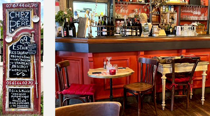
The day before, on our walk to Bessuéjouls, we passed the intriguing sign for a restaurant in Estaing called Chez Mon Père (at my father’s house). It turned out to be right across from our hotel, and that’s where we had dinner. The exuberant sign gives a clue, as does the decor: this is a joy-filled place to share a good meal with friends. Always a good sign: it was filled with locals.
It was Ascension Day, a national holiday in France. That fact, combined with a long walk totally devoid of any place to eat, meant that our first task of the day was to pick up sandwiches from the bakery before leaving Estaing. That done, we were able to turn our attention and energy to a walk that was almost entirely uphill to our next stop in Golinhac. It was difficult, but the terrain was varied and simply beautiful.
The route out of Estaing almost immediately turned steep. Eventually the trail relaxed a little—still climbing, but not as steeply, and we came to a more open vista of farmlands and forests. That’s Claude below me, steadily making his way up.
This hill is so steep that the tree looks like it has lost the battle to stand up straight.
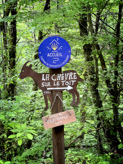
A sign advertising accommodation in a place called La Chevre sur le Toit, the Goat on the Roof.
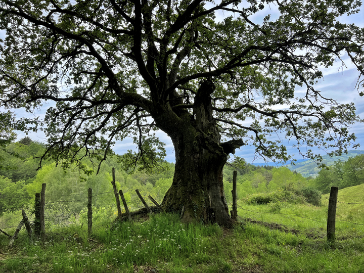
The route continued uphill, passing through a mix of open farmland and lovely forests. This section of the Chemin is breathtakingly lovely, and the forests had an effect on me that was at once invigorating and calming. My whole body felt nourished and refreshed. It was exquisite.
I could have sat all day at the foot of this tree that embodies both wisdom and whimsy.
This is almost the definition of the perfect trail for me, with the added bonus of a lovely afternoon to be walking.
Claude jumping over a small stream.
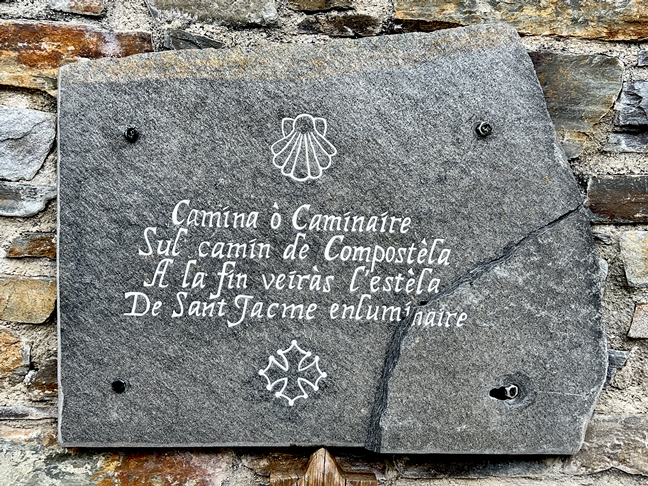
In the center of Golinhac is this recent stone marker, written in Occitan: “Walker (f.) or Walker (m.) on the way to Compostela At the end you will see the star Saint James enlightened.”
Golinhac is where I learned that I’d made a mistake with our reservations; we were double-booked for this night and had nothing for tomorrow night, the Friday of a busy holiday weekend. Oh, dear. Eventually it all worked out, thanks to the help and generosity of quite a few people.
Thus it was that we ate a rushed dinner in Golinhac, and then had a ride to the next village, Sénergues, by our host David. At their house, his wife Julie greeted us warmly, and the four of us chatted over Julie’s delicious Bakewell tart. Some time later, after a hard day’s walk and a wee bit of stress, the comfy beds were calling our names.
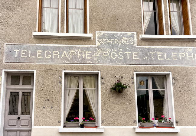
Our chambres d’hôtes, the delightful L’Ancien Poste, is housed in the former post office, a place where you could send a letter or a telegram, or make a phone call. David and Julie were friendly, generous and helpful hosts, and their home is lovely.
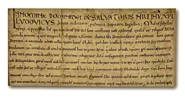
Sénergues is a sleepy village, but it has an intriguing claim to fame. Louis The Pious, son and heir of Charlemagne, spent some time in this area and was a founder and supporter of the Benedictine monastery of Conques. The Sénergues church displays a replica of his charter, dated 8 April 819, which gives churches and grants protections to the abbey of Conques. The Sénergues church is the first one mentioned in this charter. In 2019, to celebrate the 1200th anniversary of this event, the village renamed its main street Rue Louis le Pieux.
Due to all the confusion surrounding our accommodations, we decided it would be more efficient for David to take us into Conques, because he knew a couple of people we could speak with about finding rooms for the night. This turned out to be the right decision, as we were there to see masses of pilgrims arrive throughout the afternoon, along with tourists in cars. We did eventually find rooms for the night, so we left our luggage at the hotel and went off in search of lunch. Whew.
And that left us an extra day to see Conques and its surroundings. We were able to explore the lovely medieval town, took two good hikes in the surrounding (steep) hills, and spent a lot of time admiring the exquisite Conques church.
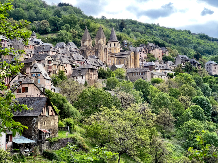
The pretty village of Conques sits on a steep hillside in a heavily-wooded area. Thanks to the intricacies of the hills and the tucked-in setting for the village, Conques is completely hidden from view from all approaches until nearly the moment you arrive. This setting has provided great protection for the abbey and its village for over a millennium.
Most of the architecture of the village is late-medieval half timber (colombages in French). There are still several of the original town gates; one of them is seen in the photo at right, the Porte Vinzelle.
One afternoon we walked uphill out of the village, heading in the opposite direction of Compostela. We topped out near a farm where the hay had just been cut. The walk was steep, along a narrow forest path that had stone walls along one side and a high berm on the other side. On the return, I took one look at this pebble-strewn chute of a trail and made the quick decision to treat it like a ski run. Facing downhill, poles in hand and a giant grin on my face, I practically sang the skiing mantra: pole-hop-turn-pole-hop-turn… for about 15 minutes. Bliss!
The next morning we went the opposite direction: down, down, down out of the village to the Dourdou River and its Pont Romain. We crossed and then began another very steep ascent through a lovely forest, on our way to see the Chapelle Sainte-Foy. I sympathized with the way-marker that appears to be tired of holding itself upright. My favorite part of this chapel is that it’s the only one I’ve seen where visitors are encouraged to ring the bell, which is harder to do than I thought it would be.
The glory of Conques, though, is its abbey church (technically not a cathedral, although it looks like one). The friendly folks at the visitor center told us about various tours that were available, and we signed up for three of them.
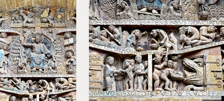
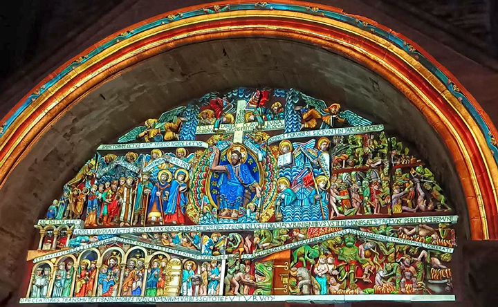
The Abbey Church of Sainte-Foy in Conques is one of the oldest churches on the Via Podiensis route to Compostela. An earlier church was built in the 8th century. It was destroyed in the 11th century to build this one, roughly between 1045-1100, with the west portal and tympanum being completed by 1120. The tympanum is sculpted in remarkable detail, and depicts Christ in the center, presiding over the weighing of souls; heaven and hell are below his feet to the left and right. Easily visible are some of the original colors, especially at the top where it’s more sheltered. I’d love to stand below this portal with someone who can tell me who each figure is, but in the meantime, I can say that Charlemagne is here, as is a much-despised local bishop who is depicted in hell. The hand of God is also here, reaching out to Sainte Foy.
A closer view of the blue-clad Christ, his right hand pointing toward heaven and his left toward hell. Beneath his feet is the contrasting view of the portals to the two domains: entering hell involves being swallowed by a terrible beast and then excreted into hell.
Every night there’s a terrific light show that projects colors onto the tympanum, following the clues of the remaining bits of color. Photograph by Claude Vachez.
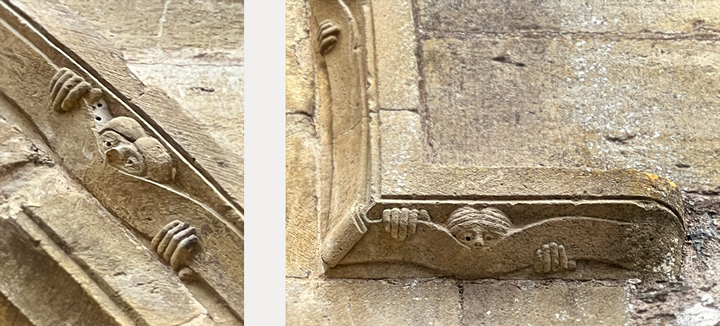
Arrayed along the outermost arc of the tympanum are peeking figures which are referred to as “Les Curieux,” the curious ones. They look much like the “Kilroy Was Here” figure popularized by American GIs during World War II. I’ve never seen anything like this on a church; for me, it exemplifies the depiction of humanity that is so central to medieval art. There is a delightful warmth and innocence about these faces peeking at the awe-inspiring tableau of Judgment Day.
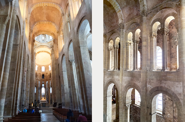
The interior of the Sainte-Foy church is Romanesque in style. There were frescoes here, and there are about 250 columns with ornate capitals with a variety of designs: some tell stories from the bible as well as daily life; some have intricate interlacing patterns (entrelacs in French) that are Carolingian in origin; some are botanical; some depict animals or beasts; and there is a whole group of capitals dedicated to the life and martyrdom of Sainte Foy. We took a tour of the upper gallery, which covers the entire perimeter of the inside of the church and offers a closer view of the capitals. Photo at left by Claude Vachez.
Left, Saints Gabriel and Raphael. Right, another depiction of Gabriel.
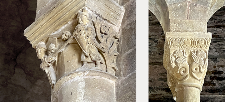
Warriors and fantastic beasts are plentiful.
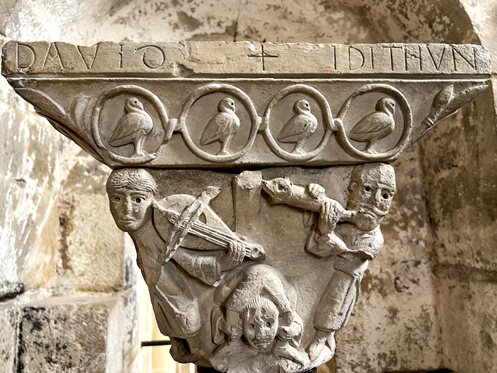
A lovely capital showing King David playing a hurdy-gurdy and Idithun playing a leather horn that ends with a serpent head.
The reliquary statue of Sainte Foy, created during the 9th century and modified in the 16th century. Photograph at left by Amy Rebecca (on Reddit); photograph at right from Web Gallery of Art.
A medieval whodunnit The Abbey Church of Sainte-Foy is home to one of the most valuable religious treasuries in Europe, a mind-boggling array of gold, silver, enamel, and precious gems. The greatest of these by far is the reliquary statue of Sainte-Foy.
Sainte Foy (Saint Faith in English and Santa Fe in Spanish) lived in Agen, about 200 kilometers southwest of Conques. She was martyred at the age of 14, around the year 300, during the reign of Diocletian. In the 5th century, the bishop of Agen built a basilica dedicated to her.
Some time in the 8th century, monasteries began to be interested in acquiring relics in order to attract visitors and the riches they would bring. The monks at the abbey in Conques were no exception, and they tried to purchase their own relics, but had no success. They hatched a scheme: a monk from Conques joined the abbey at Agen. He worked there for ten years (!), slowly gaining the trust of his superiors until he was eventually put in charge of protecting the relics of Sainte Foy. And in 866, he ran off with the relics, straight back to Conques.
The folks of Agen gave chase, but it is said that one of Sainte Foy’s miracles was to repel all pursuers until she was safely ensconced in Conques. The church, originally dedicated to Saint-Saveur, was rededicated to Sainte Foy, and the theft is now delicately referred to as a “furtive transfer.”
The initial form of the reliquary was fashioned of yew wood and covered with gold. The head, masculine in appearance and made of a different gold, was taken from another sculpture, possibly a Roman emperor’s effigy. The wooden torso contains the relic, Sainte Foy’s skull. The reliquary is nearly 84 centimeters tall, 33 inches. It is unique in the world, as no other Carolingian reliquaries of this quality or value exist.
And that is the story of Conques, the end of the pilgrimage route that Claude and I began in Le-Puy-en-Velay in June 2022.
Here’s a web site with some great info about Conques (in English).
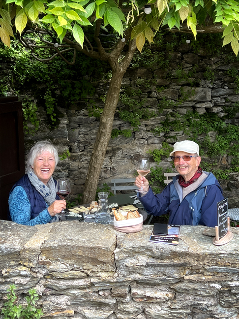
Celebrating the completion of our walk on the Via Podiensis, from Le-Puy-en-Velay to Conques, about 205 kilometers.
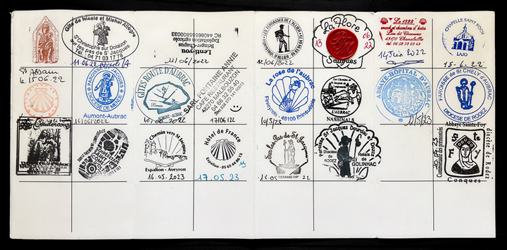
An update from last year: my pilgrim passport (credencial du pèlerin in French), showing a stamp for each day on the walk. Most are from the places where we lodged, and three are from religious sites. There’s a blank square for the stage between Golinhac and Sénergues.
Parting Shot In the UK, one of the myriad familiar terms for a toilet is “WC,” which stands for “water closet.” The French have embraced this abbreviated term, and the French pronunciation of the two letters is “vay-say,” which also happens to be the pronunciation of the place named on the lower sign. Complicated, I know, but Claude and I got a good laugh out of this, the toilet village.


Delightful as always! Please continue. The photos of the ancient churches & architecture are stunning. Thanks do much.
LikeLike
Thank you for reading, and thanks very much for your kind words. I’ll be back soon with flowers of the Chemin!
Lynne
LikeLike
What a beautiful post. Thanks so much for sharing with us. Much LOVE to you.:)
LikeLike