
And they’re off!
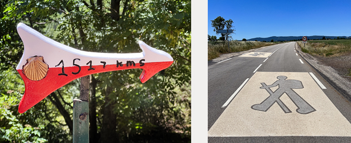
As I wrote in the previous post, we began our walk in Le-Puy-en-Velay, a lovely historic city about two hours southwest of Lyon. It’s one of the ancient starting points in France for the pilgrimage to Santiago de Compostela (Saint-Jacques de Compostelle in French) in northwestern Spain, 1,522 kilometers away (946 miles).
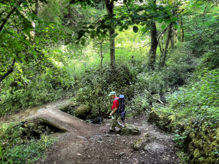
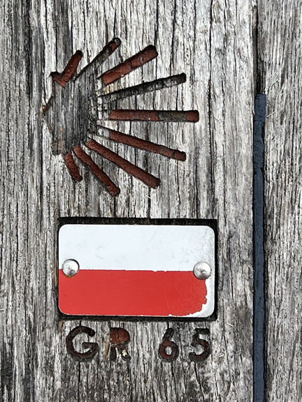
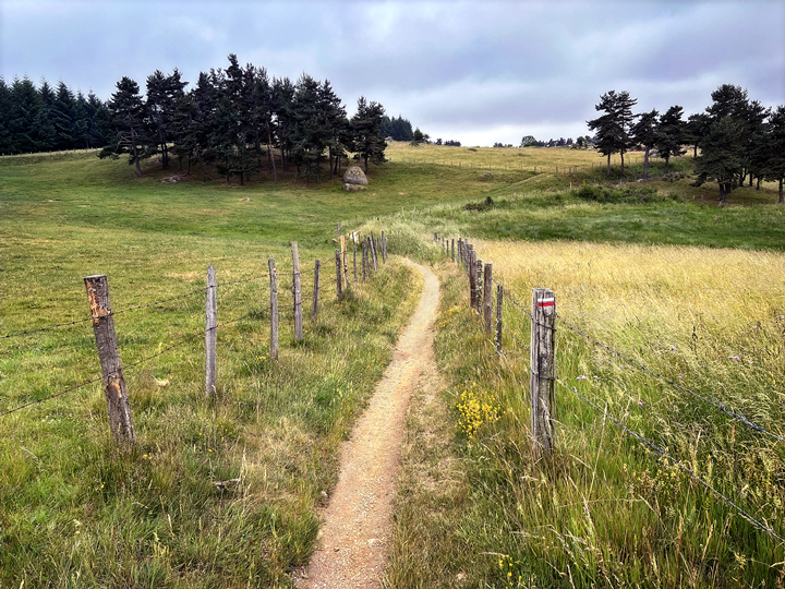
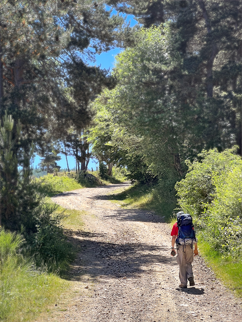
This route is often called the Via Podiensis, although its more utilitarian name is the GR 65, where “GR” stands for Grande Randonnée (great trek). All of the GR routes are marked with a white-and-red blaze, which you’ll see in the photos below. This section of the GR 65, between Le Puy and Conques, is considered by many French people to be the prettiest in all of France. Our plan was to walk half of it now, and half later. When we started out, I tried to say “Conques or bust!” to Claude. As often happens, it fell flat, but we finally figured out that “Conques ou rien!” would be the translation (Conques or nothing).
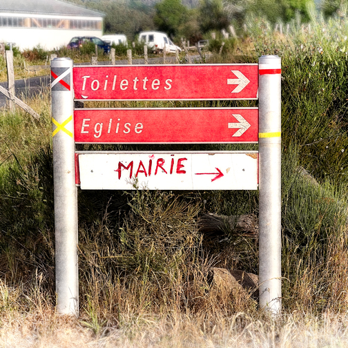
Another mark of the Chemin de Saint-Jacques/Santiago de Compostela route is the scallop shell, the symbol of Saint James. It’s everywhere, indicating the route as well as places where pilgrims are welcome for food, drink, a place to sleep, and pretty much anything else a pilgrim might need. You’ll also see the shell in photographs.


We purposely chose to start the trip with shorter walks, to help us ease into a routine. Our first night was a farm stay in Saint-Christophe; other guests included a group of friends who were walking together, plus one woman who was on her way to Le Puy to meet her group. Thus there were six women plus Claude, which became a bit of a theme, as we noticed there were a lot more women than men walking the Chemin.
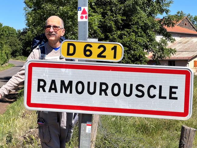
Our second day took us toward Montbonnet. We couldn’t get accommodation there, so we ended up staying in a nearby hamlet, Ramourouscle. We were both quite taken with that name! We arrived, left our packs, and walked to Montbonnet for lunch and a look around.
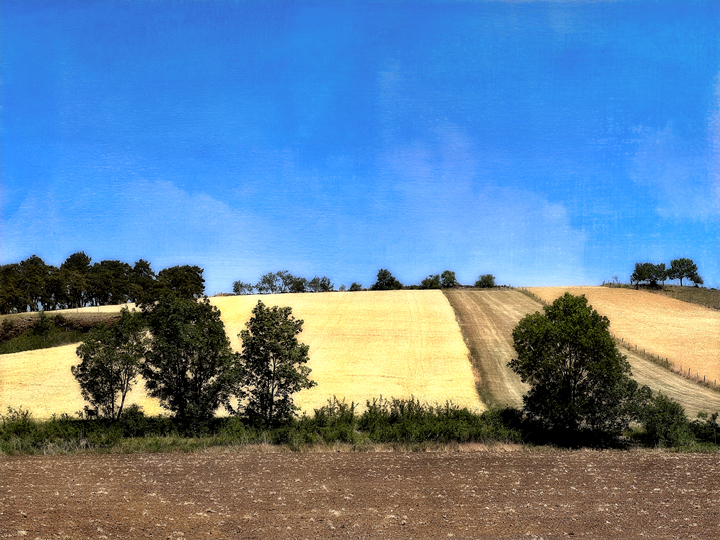
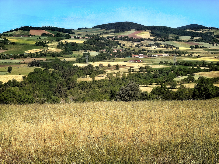
This region is part of the Haute-Loire, a volcanic area with fertile soil that produces the famous green lentils of Le Puy, plus cereal grains. We were beginning to see fields of rye, which has a bluer hue than wheat.
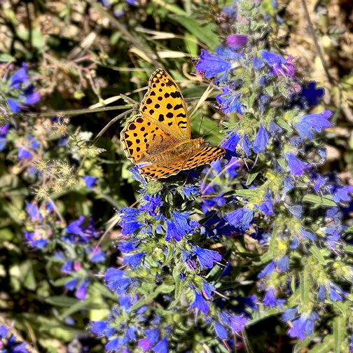
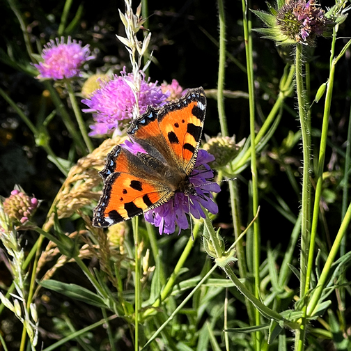
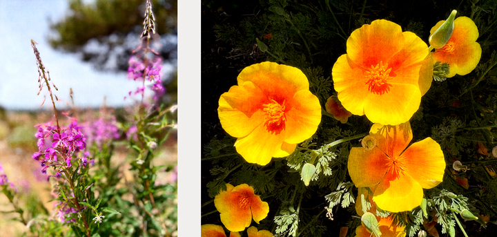
We also saw a lot of butterflies and wildflowers, and the birds serenaded us wherever we went.


In Ramourouscle, we stayed on a farm that offers a variety of accommodation, including tents on the back lawn. Dinner last night—which included delicious Le Puy lentils—was at a large table outside, with around 12 of us enjoying camaraderie, conversation, and good food. That continued at breakfast, although the conversation was quieter, the people a little sleepier.
Our third day on the Chemin was a little longer; at the end of the day, both of our phones indicated we’d walked over 20 kilometers, which is not what the guidebooks say!
We walked through varied terrain, still accompanied by birdsong. There was Claude-song, too, as he would occasionally burst out singing while he walked along.
We were headed to Monistrol d’Allier, but first we had to climb some more and then descend quite a lot.


The photographs pretty much stop here, because the remainder of our walk was difficult. We had a steep drop from Rochegude via a nasty long stretch that was steep, dusty and extremely slippery. There weren’t even places to stand still. Since this was a long day already, we were both pretty worn out, and we still had more descending to do before we arrived in Monistrol d’Allier, our stop for the day.
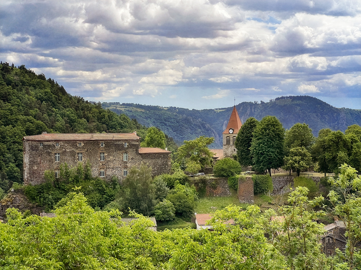
Monistrol d’Allier is on the Allier River at the bottom of the Gorges d’Allier. The terrain is steep, rocky, heavily wooded and would be absolutely beautiful were it not for the giant electrical station and its accompanying high-tension cables. Alas, we all use electricity, so the lines are a fact of life, but for the next several days, our walk involved constant crisscrossing under these high-tension lines. I didn’t much care for that aspect of our journey.
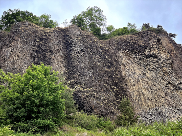
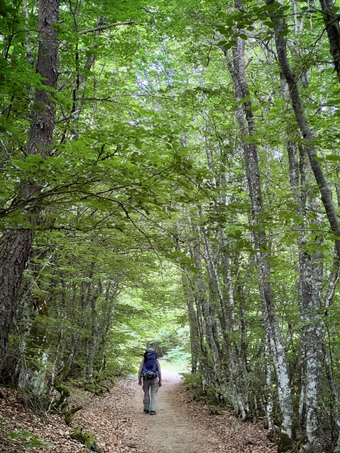
Instead of thinking about that, I focused on the pleasures to be found on a long walk such as this one. One reason that the French people find this to be such a beautiful trail is that it traverses a great variety of scenery and land formations. On this day, we were leaving behind the volcanic parts of the Haute-Loire and entering La Margeride, which is marked by the gorges of the Allier River. This is a higher-elevation region of granite and wild open spaces, located in the Massif Central and spanning the corner where three départements meet: Haute-Loire, Lozère and Cantal.
Another of the pleasures of such a long walk, especially one with such a strong spiritual theme, is the sense of community among those who are walking and those who are providing for the walkers. People help each other and share what they have; there is always a warm smile and a greeting to be found. There is kindness, respect, conviviality.
Inevitably, there will be those we see more than once, or for more than a day or two, and with those, there is an extended conversation and an even greater bond that is formed. At our inn in Monistrol, we met three delightful people: two friends, Sylvie and Isabelle, who were traveling together, women I could imagine being friends with if we lived in the same place. The third was a woman who was traveling alone. Her name was Clothilde, and she had left her husband at home with their three children; she was enjoying two weeks of quiet walking in nature. Her pleasure in her adventure was so palpable that we all felt it, and felt happy for her. Throughout this day, we kept bumping into Sylvie and Isabelle, and we’d walk and chat with them for a while before we separated to go our own pace. Later, in Saugues, we spotted them again, and enjoyed a cold drink together at a bar, under the shade of umbrellas. Our farewell this time was real, though, because we stayed the night in Saugues and they were continuing on to the next village.
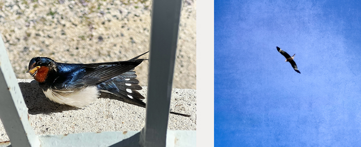
Another pleasure, one that I heard many people speak of, is the surprises along the way. There will always be surprises, and we all hope that the pleasant surprises will outnumber the not-so-pleasant ones. For example, during our day of exploring Le-Puy-en-Velay, we enjoyed several human surprises; these were interactions with locals that were so enjoyable that they left both of us feeling a nice warm glow. Another splendid surprise was the swallow chick that had landed on my windowsill the day before. One day along the trail, a butterfly landed on my hand, and stayed for several minutes, a moment of pure magic and childlike wonder.


In Saugues we had a perfect gem of a place to stay: La Flore. The day before, we were hot, dusty and tired when we arrived in Saugues, and it was too early to check in. We decided to look for the house anyway, and found it along a very busy road that was loud with the traffic of heavy trucks. We were dubious, but we saved that for later, and turned our attention toward the center of town, looking for a shady spot to have something cool to drink and take our packs off. After sharing a cool drink with Isabelle and Sylvie, we looked around town a bit and then returned to the chambres d’hôtes (bed and breakfast).
We had a warm and cheery greeting from Florence and Régis (hence the name La Flore). It’s a beautiful and spacious house, fresh, clean, well-appointed… um, a lot of adjectives I cannot use for most of our accommodations along this walk. We each had our own bathroom! It was sparkling clean! The bed was a dream! I felt completely pampered, and had a great desire to stay here for several days.
After showering and finishing the daily task of hand-washing clothes, I had a short rest, and then went downstairs for apéro; we were expected at 7:00. When I arrived, I found that there were two other guests, and all six of us enjoyed a lively conversation on the patio. One of the others was a man who was walking the Robert Louis Stevenson trail. The fourth guest was a young mother who had, like Clothilde in Monistrol, left her husband in charge of their three children, and set out for two weeks by herself on the Chemin.
We went inside for a delicious dinner, all six of us eating together and continuing our conversation. It was an utterly delightful evening, spent in the company of interesting people. The next morning, we all met for breakfast, and then, when it was time to start walking, our hosts took photos of us on their patio. I would return to stay with Florence and Régis in a heartbeat.
This was the day when the heat really set in, and we began starting our walks earlier in the morning. We still had stretches of shady forest, but not as many as before. I began trying to speed up our pace so that we could arrive at the day’s destination before the highest temperatures set in, but that proved difficult. I think Claude felt like I’d morphed into a Marine drill sergeant.
On this day we were walking toward the poetic-sounding village of Chanaleilles (shah-nah-LAY-uh), although our accommodation was in the nearby hamlet of Chazeaux. We arrived on the late side for lunch, and we thought we’d sit on the terrace to eat the lunch that had been packed that morning by Florence. Alas, the food had survived neither the journey nor the heat, so our host offered us some food instead.
Jean-Michel and Emmanuel were gregarious and enthusiastic hosts. They’d purchased the house, begun the work of turning it into a chambres-d’hôtes, and then started hosting people before the house was really finished. So, there were some unfinished walls and exposed beams here and there, but that was balanced out by the friendliness of our hosts.
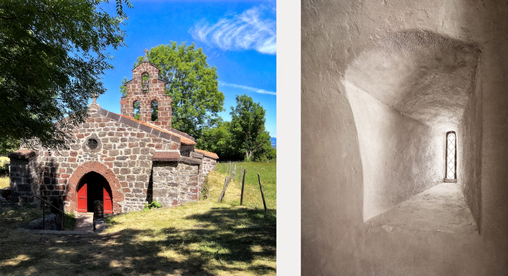
After a nice lunch and conversation, we went out for a (hot) walk to see Chanaleilles and its 12th-century church, with its remarkable wall belfry (clocher-mur or clocher-peigne in French). The afternoon was hot and quiet, punctuated only by the buzz of flies and other insects. We lethargically poked around the village a very little bit, and then returned to the dusty road back to our inn and the allure of a shower.
That evening when we went downstairs for dinner, Jean-Michel asked us if it was agreeable to us that they had invited two friends to join us for dinner. We said yes, and had a lovely time with them, first with apéro and then with dinner. During dinner, more friends dropped in; I had the sense that this happens a lot. There was a convivial, relaxed friendliness with this group. During dinner, I’d heard a nice bit of jazz in the background, and thus began several hours of Emmanuel and me talking about jazz, blues, New Orleans, B.B. King, and a host of other related musical topics. It was delightful.


The next morning, we enjoyed a yummy full breakfast, and more lively conversation punctuated with some tips about today’s walk. The morning was cool and overcast, which suited me just fine. Our goal for the day was Saint-Alban-sur-Limagnole, and there would be some interesting sights along the way.
The temperatures were rising, and in an effort to lighten my day pack, I had removed several items that I hadn’t used and/or seemed unnecessary, including a couple of guide books about the Chemin, my rain poncho, and parts of my first-aid kit. The extras went into my suitcase for the day; we were paying a service to transport our luggage from one inn to the next, each day, in order to be able to carry a lighter pack on the trail. (Well worth the cost.)


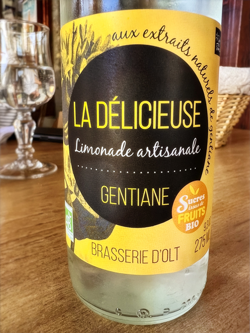
As we left the forest and its gentle climb, we came out onto a wide plateau that was filled with wildflowers. Among these was gentian, a yellow flower that makes a popular bitter liqueur. Claude had been searching for a sign of these flowers, and today was our first sighting of them.
We also had very dark skies to the northwest, and a few glimpses of distant lightning. Might it actually rain? Well… yes. We felt the first drops when we arrived at the Buron de Sauvage for a coffee break. I was eager to keep walking, but Claude wanted his coffee, and it was a good opportunity to pull out our rain ponchos and cover our backpacks. Except I had no poncho. Frankly, I don’t really like wearing plastic, especially when the temperatures are still warm, so I didn’t miss it. My pack has a built-in rain cover, though, and I did pull it over the pack. The rain turned out to be more of a fine mist, which felt delicious on my skin, and I never missed the poncho.

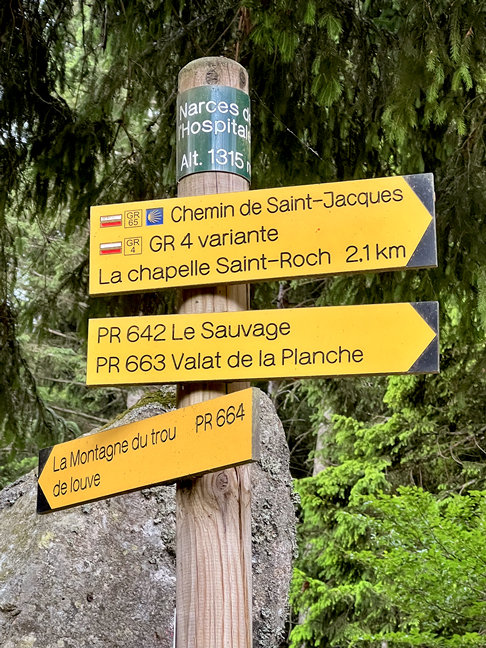
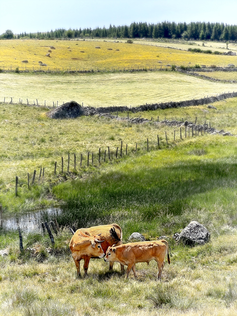
Our next stop was the Fontaine Saint-Roch, on the site of a medieval Templar hospital that served pilgrims; it’s now completely demolished. The waters of the fountain are said to aid various maladies, and also to be potable, although I saw cows just beyond the fountain and decided not to risk a giardia infection by drinking it. Claude did, though, and I never heard him complain of the icky effects of this infection.
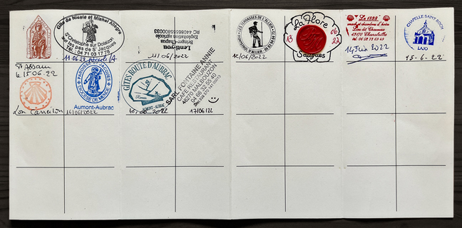
We crossed from the Haute-Loire département into the Lozère, and then arrived at the Chapelle Saint-Roch, where we got stamps in our pilgrim passports. Most of our other stamps were from the places we stayed each night; this was one of two from religious sites.


The sun had come out, the temperatures warmed up, and it was a relief to find a shady rock to eat the picnic lunch that Jean-Michel had prepared for us. Then we hoisted our packs, walked into the sun, and eventually arrived on the outskirts of Saint-Alban-sur-Limagnole.
Our hostess had instructed Claude to call her when we arrived in the town, which he did, and she said she’d come pick us up. This seemed excessive, but once we began the drive, we both understood why. The town is perched on a hill, and we had entered on the uphill side. From this location, the road into town breaks up into several smaller roads, none of which goes straight. They curve and twist and cross each other, and our hostess explained that people tend to get lost trying to find her house. It was nice to have the ride!
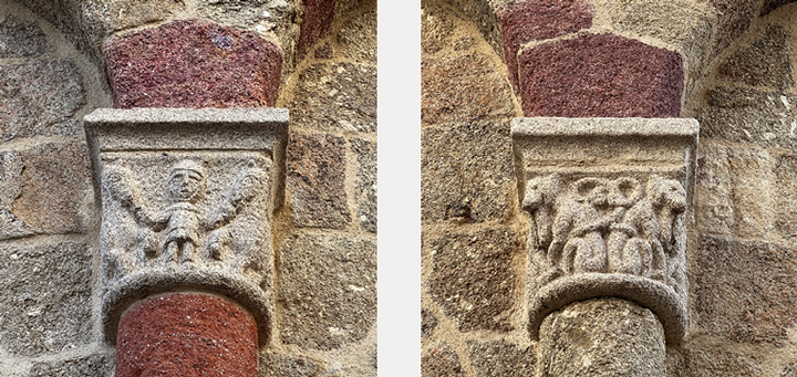
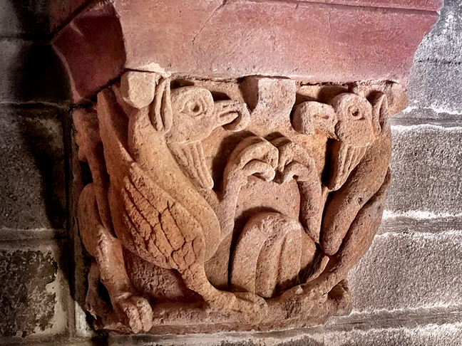
We left our packs in our rooms, and then went out to see the village. The church—L’Église de Saint-Alban—was built late in the 11th century, and it includes some vivid red sandstone that is found in the area. The interior column capitals appeared to all depict various kinds of plants, but those on the exterior have more fantastical creatures. I read that these include a troubadour playing a musical instrument, gryphons, mermaids, and a centaur, although I didn’t see all of those.
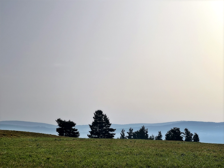
We left at 6:30 to try to beat the heat, and were treated to mystic scenes of the rising sun dancing with foggy hillsides. We were still in hilly country, but didn’t have the large elevation changes of previous days, instead beginning our day with a small climb out of Saint-Alban, followed by a gentle descent to Les Estrets and the Truyère River. This day’s destination was Aumont-Aubrac.

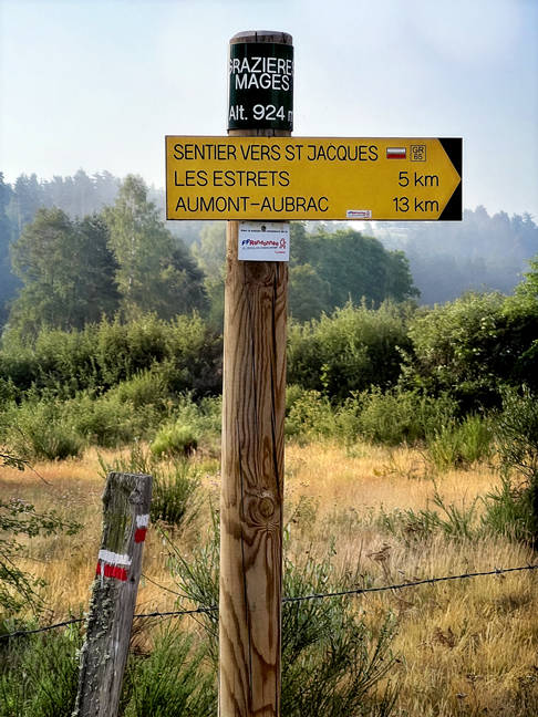
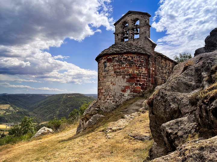
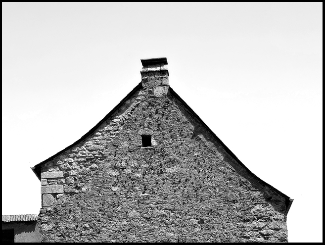
Les Estrets is a picturesque village with a medieval chapel that includes remnants of a Templar hospital; the village had been a Templar command post.


In Aumont-Aubrac we stayed in a gîte-d’étape, which is a hard term to translate; it essentially refers to inexpensive lodging, often dormitory-style and used by pilgrims and others who are walking a multi-day route (étape means stage, step or leg, as in a multi-stage journey). The combination of the type of lodging and our 6:30 departure meant that we were on our own to figure out some kind of breakfast, which ended up being a bad shot of espresso and an even worse croissant. Oh well.
But we had a nice attitude adjustment when we stepped outside to a fresh clear morning and the sight of the setting moon. We turned west toward that moon, and walked toward Malbouzon, our stop for the night.


This was another long, hot day, relatively shade-free. Somewhere en route, I lost my sense of humor, and it was a while before I found it again. We passed a lot of cattle, swatted a lot of flies. Our path took us through La Chaze-de-Peyre and Les 4 Chemins; we saw la Chapelle de Bastide and an old mill house called Le Moulin de la Fouolle. We stumbled into Malbouzon and found our lodging for the night, another gîte d’étape, and it did nothing to improve my humor, although the shower helped.
In Malbouzon, we met two pairs of friends, Annie and Kadou (from Geneva) and Bruno and Jean-Luc. We enjoyed conversation with them and shared a table with them at dinner. I especially enjoyed talking with Kadou, a midwife whose family are Bedouins from Algeria.
Claude had been having some trouble with his feet, and his blisters had become so uncomfortable that we decided to skip the last, very short étape of our route, 9 kilometers into Nasbinals. He asked around and found us a ride leaving mid-morning.
We arrived in Nasbinals on a busy Saturday morning. There was an artisan market to browse through, and we learned that the next day would see a marathon with a few thousand participants. There was a notable contrast between the dusty pilgrims walking with scallop shells on their backpacks and the sleek distance runners wearing neon-hued running gear.
As with Le-Puy-en-Velay at the start of our journey, we had planned two nights in Nasbinals, time to see the village itself and to visit the nearby hamlet of Recoules d’Aubrac. We browsed the market, made a few purchases, and then returned to our hotel and its bar for a nice lunch in the shade.
We enjoyed a quiet afternoon exploring the village and had time for a siesta before dinner. Our hotel was a delightful surprise, newly decorated, clean, restful, comfortable. The restaurant served delicious meals, and—always a good sign—there were a lot of locals among the patrons. I highly recommend the Hôtel de France in Nasbinals.


Alas, not the hotel’s fault, at 4:45 the next morning I was awakened by a blast of loud music and a booming voice on a loudspeaker. Ah, the marathon. We eventually made our way downstairs to watch the start of one of the many waves of runners (it turns out this was several races held on one day).
Later in the day, we took a taxi to the hamlet of Recoules d’Aubrac, passing the Bès River and its medieval stone bridge, the Pont de Gournier, which is still in use. I had visited this hamlet last fall, and tried several times to get into the 12th-century Église Saint-Saturnin, a Templar church said to have beautiful red sandstone column capitals. This time, Claude had phoned ahead and we had a pretty good idea that the church would be open.
It was, and it did not disappoint. We had a good look around and took a lot of pictures. Then we explored the tiny but photogenic hamlet, quiet on a Sunday. Our taxi returned for us and we went back to Nasbinals happy with our outing.


The next day we took the shuttle Claude had reserved for us, driving in a couple of hours what had taken us eight days to walk. We picked up my car and drove back to the house where we’d stayed at the start of this journey, for one last night in Le-Puy-en-Velay. We had some shopping to do, a few things to see one more time. It was interesting to return to the place where we had begun, and to look at it from a slightly different perspective. I quite liked Le Puy, and would gladly return for another visit. There is much to see and do there.
The section of the Chemin that we chose to do, from Le-Puy-en-Velay to Conques, is somewhat more than 200 kilometers. We had decided to divide it into two parts, and had planned to do the second part this September. Given the heat of this summer, and the likelihood that temperatures could still be high in September, we decided to move Part Two to next May. I’ll be back with more of the Chemin next year. Meanwhile, if you’ve made it to this point, you have earned my heart-felt thanks for reading what has turned out to be quite a tome. I hope you’ve enjoyed it.


Gorgeous pictures, beautiful travel writing!
LikeLike
Richard, how delightful to hear from you! Thank you for your generous compliments. I hope this finds you doing well, and still thinking about Europe.
–Lynne
LikeLike
Fascinating, can’t wait for Part 3!
LikeLike
Hi Candace! Thanks so much; I’m glad to hear you enjoyed this. There will be a few posts on other topics for a while, with Part 3 coming some time after May 2023. Bisous, Lynne
LikeLike
So beautiful!
LikeLike
Hello Gaston, thank you for your kind words and for taking the time to send a message!
–Lynne
LikeLike
Great pictures & commentary. Like Candace, I’m looking forward to Part 3. Please say there will be a part 3. lol!
LikeLike
Hi Cathy, thanks for your enthusiasm! Yes, we still have the second half of the walk to do, which will be next spring. It’ll be a while, but more is coming!
–Lynne
LikeLike