Continuing from my previous post on Ireland, this post is about the 17 days I spent in Donegal, finding beauty, history and plenty of good craic (pronounced crack, meaning fun). I was based in Rathmullan on the dramatic and beautiful Fanad Peninsula.
Contents • Fanad Peninsula, including a good story • A day trip to the north • A day trip to the south • A day trip to see some beaches • Places to eat, drink and be merry
I arrived a little early to the house I’d rented, and one of the owners was just finishing tidying up. Charlotte greeted me with a warm welcome, and then she did me a real kindness: when I asked where to find a grocery store (shop), she told me that the closest good one was 20 minutes’ drive from the house, and then offered that I could follow her there when she left. This turned out to be out of her way, but ever so helpful to me.
Later that day I had a message from Charlotte’s husband Kieran, asking if he could drop by the next day to meet me, followed quickly by another message asking if he could invite his friend Martin, who likes to speak French. And suddenly I had two tour guides for the afternoon, and a fine introduction to this corner of Donegal.
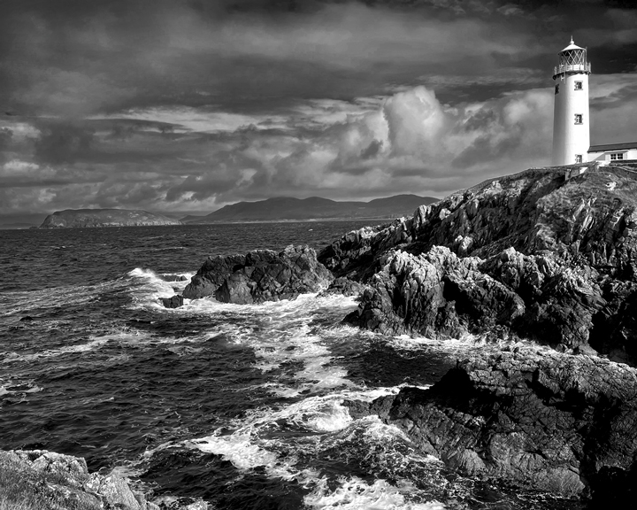
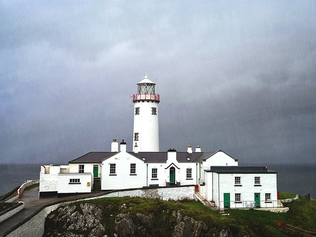
It all started when one of them said I must see Fanad Head Lighthouse, just up the coast from Rathmullan. It was high on my list to visit, but before I could say that, the conversation quickly swerved to “Let’s go there now!” And off we went.
There was rain and there was wind, not the ideal weather for clambering around on rocky cliffs, so we decided to go inside for a tour of the lighthouse. The tour included some great information about Fanad Lighthouse’s position at the head of Lough Swilly, one of three fjords in Ireland, and the rich history of Irish lighthouses. And we got to climb to the top of the light!
“Welcome to Fanad Head.”
We were all looking for hot drinks, but this sign is directing us to the ice cream stand, where there was no one in line.
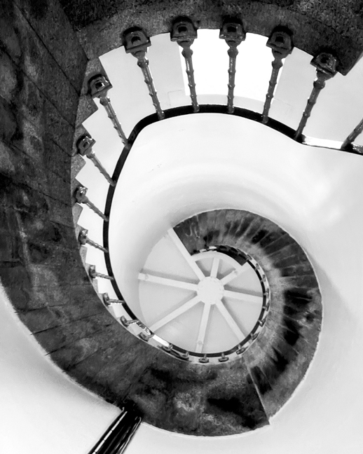
A view from beneath the stairs leading to the top of the lighthouse.
Looking out at the northern Atlantic Ocean from the top of Fanad Lighthouse.
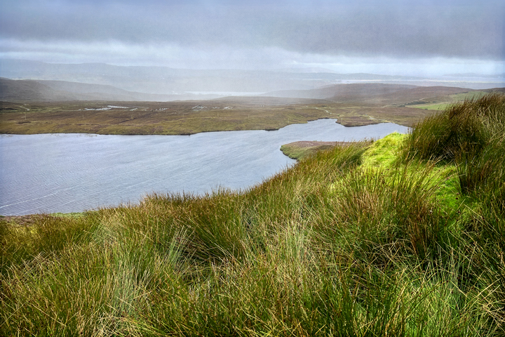
Toward the end of my stay, I returned to Fanad Head to get the picture that opens this post, plus this one, of sheep blending in with their rocky surroundings.
After the lighthouse, our tour continued with a meandering drive around the Fanad Peninsula, where we saw a one-room schoolhouse that had only recently closed, charming villages with promising places to eat or listen to music, and enticing places to hike amongst the blooming heather. We finished at the waterfront in Rathmullan, where my guides filled me in on an evocative moment in Irish history.
The Flight of the Earls
In the dark of night on 14 September 1607, the last three great leaders of Ireland’s Gaelic order quietly boarded a ship near Rathmullan and set sail for the continent. They never saw Ireland again.
The English domination of Ireland, which had begun in the 12th century, dramatically accelerated during the time of the Tudors, primarily Elizabeth I. The process was called plantation; Irish lands were confiscated, turned over to the English crown, and populated by English and Scottish immigrants. The largest of these was the Ulster Plantation. The English considered this to be the best way to destroy the Gaelic order, to Anglicize the island, and to subdue its people, who were viewed as inferior in all ways. The effects of plantation are still being felt today.
Three chieftains of the province of Ulster were among the last to hold power and the last to rebel against the English. The three were the Earl of Tyrone, Hugh O’Neill; the Earl of Tyrconnell, Rory O’Donnell; and the Lord of Fermanagh, Cuchonnacht Maguire. It was Maguire who planned the journey and procured the ship in France; he sailed with it from Dunkirk to Rathmullan, and narrowly escaped capture when the British temporarily seized the ship. The chieftains’ departure from Ireland later came to be called The Flight of the Earls.
The three leaders left only as a last resort, primarily in search of funds and armies to aid their cause, and possibly alsoto avoid arrest on charges of treason.They had already secured support from Spain, and hoped for more. The leaders left with close to 100 of their family members and supporters, and landed in Normandy after 21 days at sea.
From Normandy, they traveled overland into Spanish-held Flanders, hoping for an invitation to Spain. It never came. The group then proceeded south, making a difficult journey through the Alps; in April 1608 they arrived in Rome, where they were received by the pope. They immediately began working to find aid, but this proved to be futile.
Rory O’Donnell died on 30 July 1608, at the age of about 33, and is buried in Rome. Eight years after arriving, Hugh O’Neill died in Rome on 20 July 1616, after spending the last years of his life plotting a return to Ireland; he is buried next to O’Donnell. Cuchonnacht Maguire died in Genoa in August 1608. The Gaelic order died with them, and the Ulster Plantation began in 1609.
John Behan’s remarkable sculpture of the Flight of the Earls was unveiled in Rathmullan by President Mary McAleese on 14 September 2007, the 400th anniversary of the event. “Even today we struggle to fully comprehend the downstream consequences of the loss, the driving out of our great native leaders,” she said.
A close-up view of part of the sculpture, showing one of those who was left behind by the Flight of the Earls.
More of the Fanad Peninsula
Over the next two weeks, I continued to explore the wonders of the Fanad Peninsula, especially Rathmullan and Ramelton.
I took excellent walking tours in both villages, with Deirdra Friel of Donegal Heritage Trails. Deirdra knows her stuff and gives a lively, informative tour that shines with warmth and humor.
Near the waterfront in Rathmullan.
Rathmullan (Ráth Maoláin) One stop on the tour of Rathmullan is the ruins of the abbey, built in 1516 by the MacSweeney family in memory of their son. It was here that Joseph Louis Crockett married Sarah Stewart shortly before they emigrated to the American colony of Virginia. They were the great-grandparents of American folk hero Davy Crockett.
Rathmullan Abbey, built by Eoghan Rua MacSweeney and his wife Maire in memory of their son Ruaidhri, who died in 1508.
As we walked, Deirdra also mentioned that Saint Joseph’s Church in Rathmullan has a stained glass window by Harry Clarke. My ears perked up at this little nugget, as my friend Connie had turned me into a fan of Clarke’s work when I was in Westport. After the tour, I took myself right over to the church and photographed the lovely window.
Is that a Harry Clarke window in Saint Joseph’s Church in Rathmullan?
After my trip to Ireland, I began work on the masses of photographs I’d made, including the above photo of Rathmullan’s Harry Clarke window. I had bought a couple of books on Harry Clarke, and in neither book could I find any mention of this window. I also searched online with no success.
I wrote to the authors of one of the books I’d purchased, Lucy Costigan and Michael Cullen, sending them an email via their publisher, Merrion Press. From there, things accelerated quickly, and within a few hours I’d received a message from another author and expert on Irish stained glass. He told me that the window I’d seen in Rathmullan, titled Christ the King, was actually produced in 1940 by one of Clarke’s assistants, William Dowling, nine years after Clarke’s death. Mystery solved!*
* My heartfelt thanks to everyone who so quickly replied to my questions and solved the mystery of the stained glass window: –Deirdra Friel of Donegal Heritage Trails –Martin McEntee, who was in the right place to ask a question –Wendy Logue and Conor Graham of Irish Academic Press / Merrion Press –David Caron, editor of the Gazetteer of Irish Stained Glass, 2nd edition (2024), and author of Michael Healy, 1873-1941 –Lucy Costigan, author of Dark Beauty
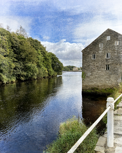
The village of Ramelton is where the River Lennon meets Lough Swilly.
Ramelton (Ráth Mealtain) I visited Ramelton several times, and one day I had Deirdra all to myself for a walking tour of the village. She provided a wealth of intriguing history and architecture, including two tidbits relating to the United States: the father of U.S. president James Buchanan was from Ramelton, as was Francis Makemie, often considered to be the father of American Presbyterianism.
McDaid’s Football Special is a legendary locally-made soft drink (called a mineral) in Ramelton.
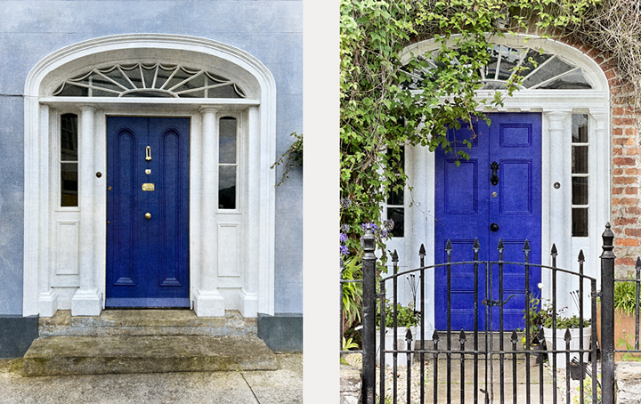
Blue front doors of two lovely Georgian homes in Ramelton.
Early warehouses along the Ramelton waterfront are being converted to new businesses, including the Blue Goat, an artisan food shop.
Did you see the movie “Love Actually”? There’s a very funny scene when Alan Rickman’s character, who is Christmas shopping with his wife, is trying to buy a piece of jewelry without her catching him. Rowan Atkinson brilliantly plays the salesperson who wraps the gift, elaborately waving his arm to add a scoop of rose petals here, a handful of cinnamon sticks there. Of course, it takes him forever to create this package-cum-work-of-art, and Rickman is dancing with impatience. This is what it’s like to order artisanal Irish cheese from Des, the owner of the Blue Goat. He creates a beautiful package of cheese, enhanced with sprigs of rosemary and scoops of dried fruit. It’s Rowan Atkinson right here in Ramelton, and the cheese is heavenly.
Other sights on the Fanad Peninsula
Martin took me to see the Great Pollet Sea Arch, seen here at low tide. The Irish name is An Aise Mhór Pollaid.
Algae and rocks at Great Pollet Sea Arch.
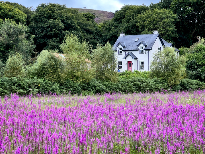
A field of purple loosestrife near Rathmullan.
From the center of tiny Glen, there are intriguing possibilities in all directions.
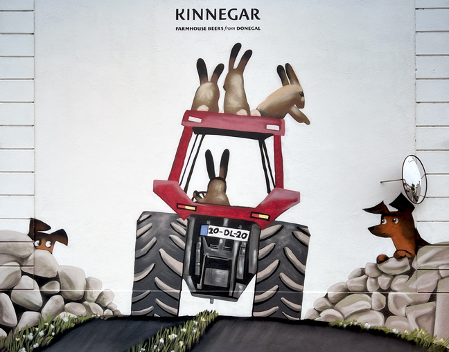
A fun wall fresco in Glen, advertising Kinnegar craft beers.
It’s called Loch (or Lough) Salt, but there’s no salt water—it’s a glacial mountain lake with fresh water. “Loch as Allt” roughly translates to “the lake out from the precipice;” the Gaelic name was later Anglicized to Loch Salt.
Lough Salt
On the other side of the ridge from Lough Salt is Lough Greenan.
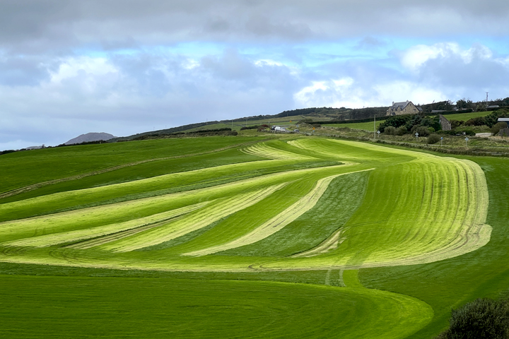
I’m groovin’ on the ombré pattern of this field, seen near the Harry Blaney Bridge.
A day trip further north
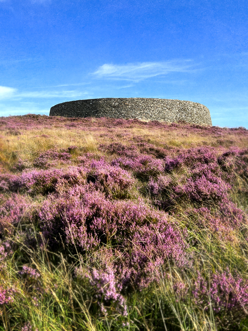
I planned one day’s outing around a visit even further north, to Malin Head, the northernmost point on the Emerald Isle. The morning began at the rebuilt circular fort known as Grianán of Aileach. Legend says this fort was built by Dagda of the Tuatha de Danaan. Archaeologists say this land has been in use by humans since the iron age. The current structure is a modern reconstruction of a fort built by the Northern Uí Néill people in the 6th century, in use until its destruction in 1101.
I made this my first stop, relatively early, as it seemed a good place for a few moments of quiet. My timing worked, because two tour buses disgorged their crowds just as I returned to my car. Whew.
Hello from Grianán!
Looking to the west from Grianán, across heather and farm fields.
Looking north from Grianán to Lough Swilly, or Lake of the Shadows, one of three Irish fjords.
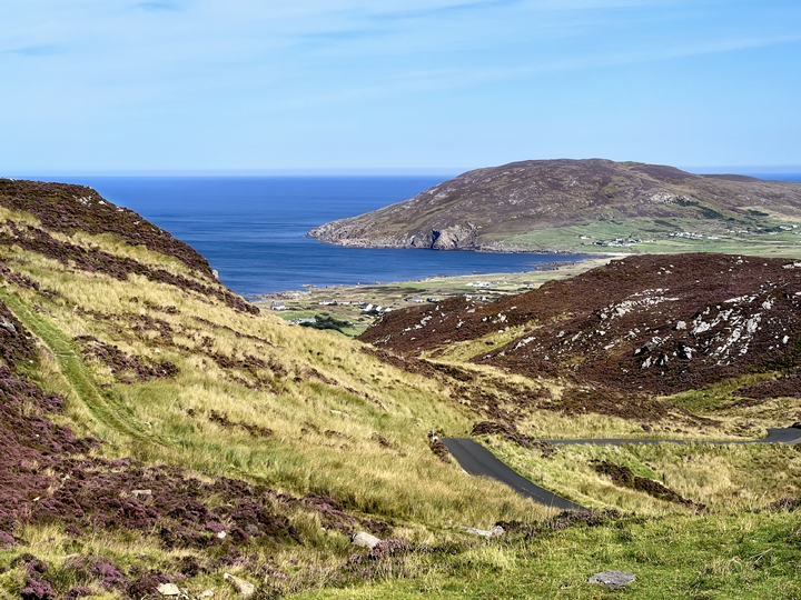
From Grianán, I turned the car toward Malin Head, but took smaller roads in order to drive over the Mamore Gap, a sweet pass that connects rolling green farmland on one side of the hills with a rocky coastal area on the other side. Here’s the approach from the south. At the top of the pass, there’s a shrine to Saint Colmcille (Columba), who was born in Donegal in 521.
Heading down the other side of the Mamore Gap.
At Malin Head, a coffee truck with a unique claim to fame.
The terrain is rugged at Malin Head, with winds to match. But what a glorious day!
The wondrous formations at the western edge of Malin Head. In the upper left is a distant view of the Fanad Peninsula.
A day trip to the south
Another day trip was planned around a visit to the Slieve League (Sliabh Liag) cliffs. I drove there first, leaving early for the two-hour drive. I arrived under low, misty clouds that dampened sound and made the uphill walk a quiet one.
From the parking lot, there is a choice of taking a shuttle bus to the cliffs, or a 45-minute walk. With my legs feeling twitchy after the drive, I chose to walk. Once I arrived at the “base area,” which is paved with food trucks selling hot drinks and others selling Irish woollens, there were a couple of viewing decks looking out to the cloud-wrapped cliffs.
There is also a relatively new stone path that climbs even higher for more vertiginous views. I was standing near that misty peak in the upper left when I made the photo of the cliffs that opens this section. I was disappointed to have such low cloud cover, but that’s the risk here. I’d like to come back one day to see the cliffs during golden hour, near day’s end.
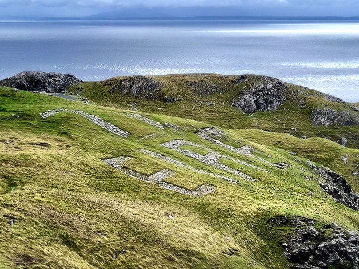
“Eire from the Air.” Ireland was officially neutral during World War II, so signs like this one—made of white stones—were installed all around the island to guide military aircraft from other nations, and to prevent bombing. “Eire” is the Irish name for Ireland.
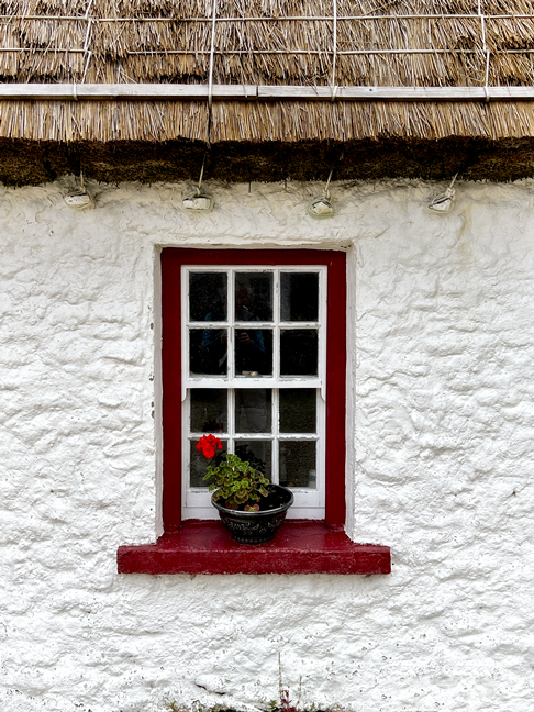
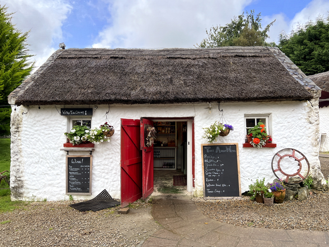
From Sliabh Liag, I drove to Glencolmcille to visit its folk village, a living history museum that was the brainchild of Father James McDyer. It’s a cluster of buildings showing the historic way of life here, including one cottage each depicting life in the 18th, 19th and 20th centuries, plus a one-room school and a shop/bar. Here’s one of the cottages, with a traditional thatched roof.
The interiors of the cottages at Glencolmcille are as authentic as possible, and locals contributed tools, furniture, household items and photographs that are used throughout the village.
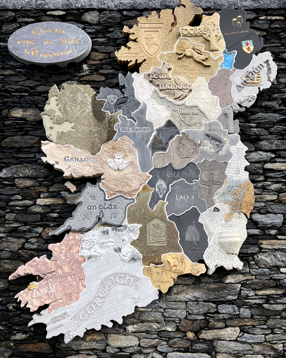
Glencolmcille is home to this magnificent map of Ireland, which was completed in 2016 to commemorate the 1916 Easter Rising and the Proclamation of the Republic. A stonemason from every county in Ireland used stone native to his or her county in making a carving that represents some aspect of that county, such as meaningful symbols, mythology, or geography. The county names are written in Irish, and the map is 15 feet tall. From IrishCentral.com: “‘Monaghan is made out of a flagstone from the floor of an old pub that was also a shop… This beautiful flagstone had been hoarded waiting for the right moment and when county duty called the carver took it out. The feet of his people were over and back on the top of that stone for generations. You can’t get more personal than that.’”
From Glencolmcille, I drove the Glengesh Pass to my next destination, Ardara. Glengesh is quite a place, a deep slash in the earth that was carved by glaciers around 20,000 years ago. I’ve seen Glengesh translated to mean Glen of the Swans, but I’m choosing to go with the sign in the little parking area at the top of the glen. It says that the word “gheis” or “gesh” was a form of taboo or curse, often placed on mythic warriors, and usually several at a time, which makes for a better story. The white zigzag on blue is the clever logo for the Wild Atlantic Way, the stunning road that hugs Ireland’s western coast.
The view of Glengesh Pass from the top. It’s easy to see how glaciers—and more recently, the river—have carved this land so dramatically.
Near the bottom of Glengesh Pass, this tidy farm has its own waterfall.
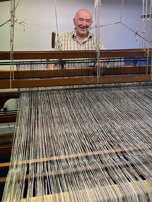
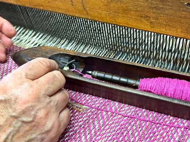
I followed my friend Karen’s recommendation to visit weaver Eddie Doherty in Ardara. He’s a master and still going strong at 84. He and his family welcomed me to their shop with warm smiles and friendly conversation.
Eddie gave me a weaving demonstration. His loom is old and well-used, the wood polished with age, and it positively sings under his deft hands. I liked the deep pink tweed he was working on, and asked if I could order a throw made of this tweed. It took a while, but I now have my beautiful pink throw, just in time for winter.
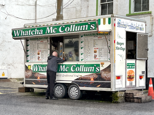
Before turning for home, I had time for a little wander around Ardara, where I saw a food truck whose owner has a sense of humor.
A day trip to see a few beaches
Ireland has gorgeous beaches, and I wanted to see a few of them. There are two things I like to do at a beach: tickle my toes by walking in the sand and the water, and photograph rock and sand formations. I spent a day doing both at three beaches.
My first stop was Dunfanaghy, where I strolled around the village, ate lunch, and spent only a little time at the beach.
It’s completely out of the context of going to a beach, but I had to record this “Black and White Face-Off” in Dunfanaghy.
I saw a lot of jellies on the beaches of Ireland, but none more elaborate and beautiful than this one. I titled it “World Cup” because I learned that Spain had won the World Cup in the same moment that I spotted the jellyfish.
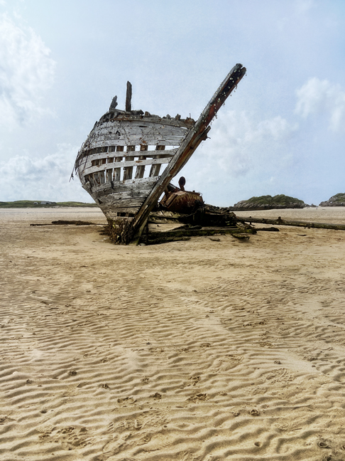
My next stop was in Bunbeg (An Bun Beag) to see the shipwreck known as Bád Eddie (Eddie’s Boat). After hanging around the boat for a while, I walked further out to a rocky area where I could stroll in the water and make more photographs.
My first glimpse of Mount Errigal, seen from the beach which is named Magheraclogher Strand, but most people seem to refer to the area as Bád Eddie.
I got a little lost in these interesting rock formations, which are mostly a lovely warm pink granite. At one point, I saw a fellow walking along a ridge well behind the closer rock formation, and sure enough, he gave me a fun composition.
My final stop of the day was my favorite, Mullaghderg Beach. There were some people there when I arrived, and then suddenly I had the whole beach to myself. It was glorious, especially with the warm late-afternoon sun.
Mullaghderg is another beach with a lot of lovely pink granite in intriguing formations.
Deeply-etched pink granite at Mullaghderg Beach.
Ocean calligraphy in the pink granite.
Other beaches
I visited other beaches, although I didn’t make many photographs. One place I did photograph a few times is Ballymastocker Strand, quite close to where I was staying in Rathmullan.
My first glimpse of Ballymastocker Strand remained my favorite through two weeks of photographing it. That is one lovely beach.
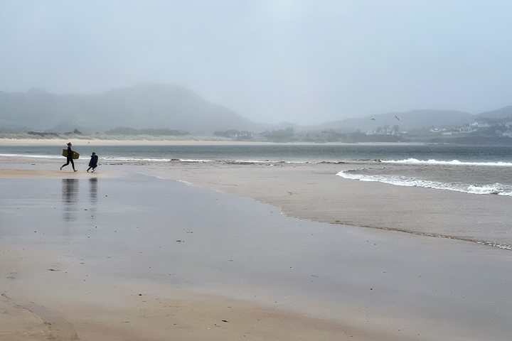
One day, I returned to Ballymastocker to spend some time walking along the shore and photographing the rocks, but a sudden downpour dampened my enthusiasm. Just as I was leaving, I spotted these two playing in the surf, their delighted laughter punctuating the quiet afternoon.
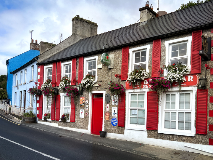
Places to eat, drink, and be merry
There was plenty of merriment to be found, usually in the form of a bar or converted cottage serving up portions of good food, Guinness on tap, a great deal of camaraderie, and occasionally, some terrific music. I said this in my previous post, and I’ll say it again: Ireland is the only place where I’ve felt completely comfortable walking into a bar, no matter the time of day, and where I was always greeted with a warm smile and a spot of conversation.
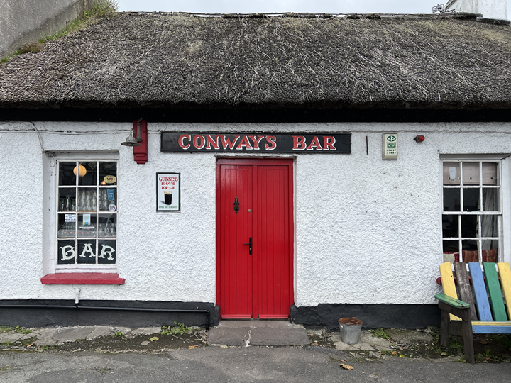
I’d heard about Conways Bar before I even left for Ireland, so it was high on my list of places to visit. It did not disappoint!
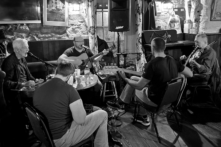
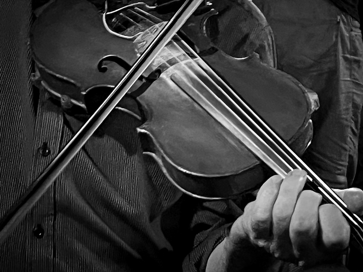
By complete happenstance, I arrived at Conways on Bluegrass Wednesday, and the place was packed. I found a stool near the bar, which meant that I got to talk to several people as they waited to place their orders; it also meant that I couldn’t see the musicians. One woman I spoke with thought the situation needed fixing, so she marched into the other room and found me a seat at a table shared by three gents. These fellows were serious about their bluegrass: every Wednesday they made the 45-minute drive from Donegal Town to Conways to hear the music. They told me that tonight’s band was considered the best in Donegal, and the music really was splendid. Getting ready to write this post, I was trying to figure out who that band was (The Hillbillies), and in the process, I found out that the man on the left and playing the dobro, Ted Ponsonby, had died about three weeks after I saw the group in Conways. There were abundant accolades; I learned that he came from a family of talented musicians, and had enjoyed a long and respected career.
When the music was officially over and people began milling about, the fiddle player came over to chat with his friends at the table I was sharing. He began playing, so I got a delightful second act before calling it a night.
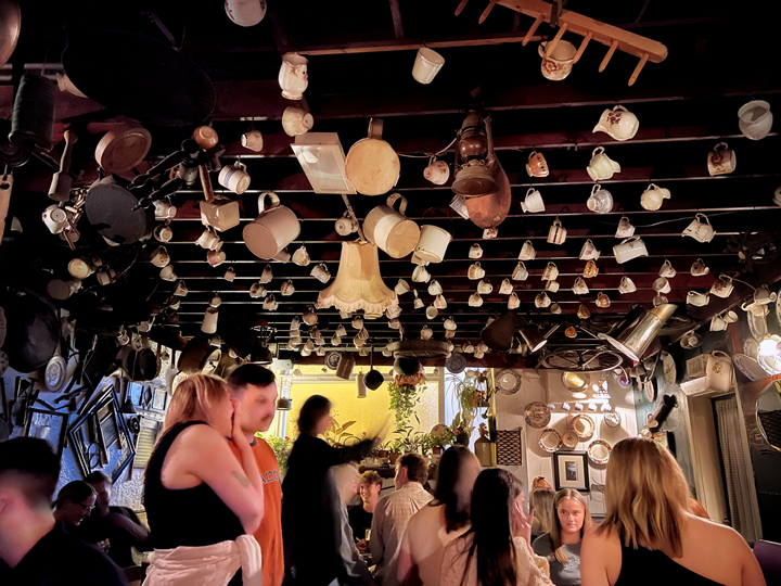
One day I had some errands in the nearest city, Letterkenny. While I was there, I stepped into the Cottage Bar and had a chat with a few patrons and the chap behind the bar, who turned out to be the son of the owners.
The nice barman told me it was his mother’s idea to hang teacups along the ancient wooden beams, and between those teacups and other nostalgic items, the bar feels cozy and inviting. I’d love to see that fireplace with a good turf fire. His parents bought the bar about 50 years ago; it dates to the late 1700s.
Near the end of my trip, I enjoyed an evening out with Martin and my host Kieran (alas, Charlotte couldn’t join us). We decided to go to the Cottage Bar, thinking there might be some toe-tapping music, but what we got instead was a very competitive quiz night! Our trio was mired near the bottom for a while, and then we surged to a third-place finish, giving us smiles to close the evening.
Just before my trip to Ireland, a winemaker acquaintance of mine told me I should eat dinner at a place called the Bridge Bar in Ramelton, which has his wine on their menu. The emphasis here is on locally-produced foods for the French-style restaurant, and the results are superb.
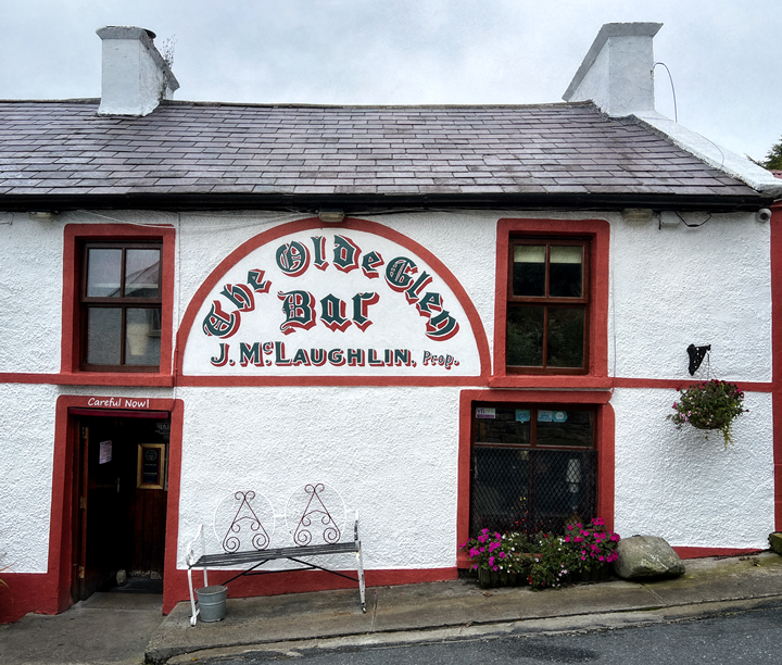
In Glen, the Olde Glen Bar (1768) is a cozy place for a pint and conversation, or a tasty home-cooked lunch. The restaurant at the back has a mention in the Michelin guide.
Pulling a pint in the Olde Glen Bar.
Coffee Time in Kilmacrenan is comprised of several thatched cottages that include a B&B, a coffee shop with great food, and this cottage serving a variety of take-out dishes. Another favorite stop that I didn’t photograph is the Narrow Quarter in nearby Kerrykeel, where there’s home-cooked food and friendly staff all day long.
Parting Shot At the end of my day of beaches, I had a long drive home, but this view of stately Mount Errigal livened up the journey. I saw it a few more times during my stay, but cloud cover prevented further views like this one. I’d love to return and climb it one day, in part because it reminds me of a mountain I did climb: Mount Rainier, near Seattle. Mount Errigal stands at 2,464 feet (751 meters).
Mount Rainier, near Seattle, stands at 14,410 feet (4,392 meters). When I saw Mount Errigal, I thought it looked vaguely familiar, so I looked online for photos of Mount Rainier. Despite the elevation difference, the two mountains bear a remarkable resemblance to each other. Photo credit: Photostorm (on Reddit).
Parting Shot #2, a shout-out Before I left for Ireland, I did a very small amount of online research to help me understand where I was going and what I might like to see there. After I’d arrived and was looking for ways to plan my days, and again later when I was writing both of these blog posts, one website stood out for its in-depth information and easy-to-use page design. You, too, might find helpful information from the good people at The Irish Road Trip.
Such beautiful, clean imagery and language that pairs well with the previous post. I felt like I was there but also the urgent need to visit this warm, stark place!
Hello Peter,
Yes, if you haven’t yet been to Ireland, do go. If you have been, go again! I left with a much longer list of things to see and do than I had when I arrived. It’s a magical place. Thanks for writing today!


Such beautiful, clean imagery and language that pairs well with the previous post. I felt like I was there but also the urgent need to visit this warm, stark place!
Peter
LikeLike
Hello Peter,
Yes, if you haven’t yet been to Ireland, do go. If you have been, go again! I left with a much longer list of things to see and do than I had when I arrived. It’s a magical place. Thanks for writing today!
LikeLike
Love the descriptions of your travels. Sounds like a lovely adventure with a history lesson along the way. Great pictures, too.
LikeLike
Hello Cathy,
You always say the nicest things. Thank you for that, and thanks for writing today.
Happy holidays to you!
LikeLike