

Two different sets of people, two different days, in the same region two hours northeast of Bize. It added up to a lot of time in the car, but it was well worth it.
On the first day, I traveled with Isabelle and Anthony to see the Viaduc de Millau, and later to have a tour of the cheese caves of Roquefort, with a refreshing picnic between the two.
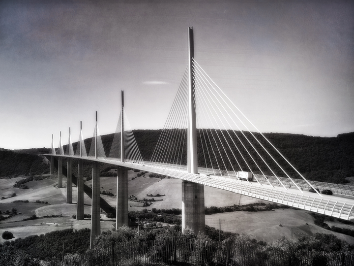
The town of Millau is nestled comfortably along the Tarn River, at the base of rolling limestone hills. The town is on the main north-south road connecting Béziers in the south with Clermont-Ferrand in the north, the A75. It’s a popular route during the summer holidays, which used to lead to terrible traffic congestion, due to both the hilly terrain and to the issues of a busy highway passing through a town.
Everyone wanted a solution, and it arrived in the form of the beautiful Viaduc de Millau, completed in 2004. The Viaduc is widely considered to be one of the greatest engineering achievements of modern times. A few interesting tidbits:
– It can withstand winds of up to 200km an hour (124 mph).
– It only took three years to build.
– It is the tallest bridge in the world (336.4 meters, 1,104 feet)

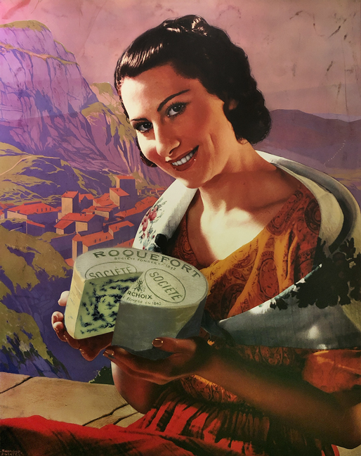
After viewing the bridge and learning about what it took to build it, we piled back into the car and turned south, then west, curving our way into the rocky terrain where Roquefort-sur-Soulzon is nestled. I found no fewer than ten towns in France that include the word “Roquefort” and there could be more, but this is the only one that’s all about a certain cheese.
However, before our afternoon tour and cheese tasting, we had brought a picnic to eat, and we needed to find a good spot to enjoy our meal. I do believe that we found the best picnic spot ever: towering trees, limestone boulders, a sublime view of the valley below, and a scattering of tables dotted under the trees. It was so perfect that at least one of us caught a few winks on a neighboring bench after lunch.

This region has been used for millennia by farmers and herders, because it’s an ideal place to run sheep. Ewe’s milk—called brebis in French—makes some especially wonderful cheeses, and it’s at the heart of Roquefort’s secret.
The legend is is that a young sheepherder was out in the hills one day, and while eating his lunch, he caught sight of a lovely girl in the distance. He tucked his partially-eaten lunch of bread and cheese into the freshness of a nearby cave, and went off to chase the girl. Some days later he returned, dejected at not finding the girl, and he discovered that the cheese and bread had molded over. Besides being sad about missing out on love, he was also hungry, so he bit into the cheese and had the eureka moment that led to today’s Roquefort cheese.
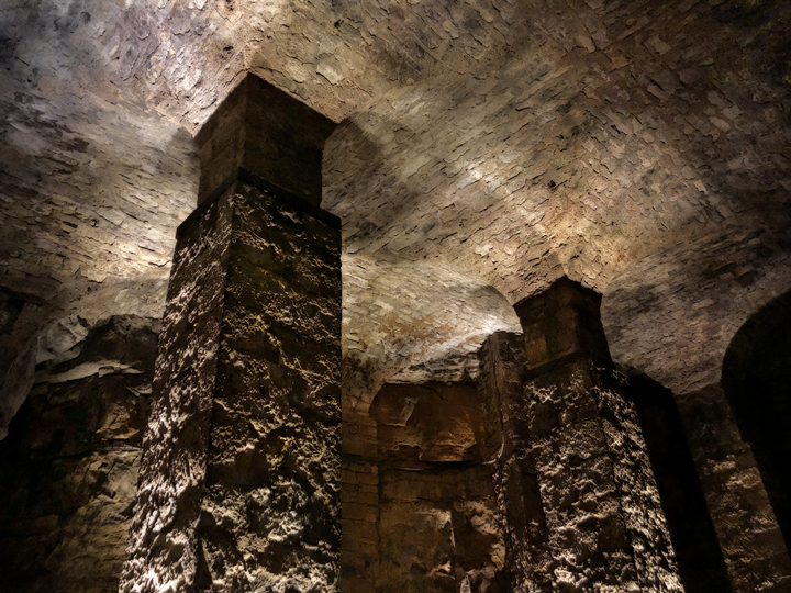
The piece of the story that is not a legend is how these caves were formed. The village of Roquefort is perched on the north slope of a steep, rocky formation. This limestone plateau is curved, making a sort of steep bowl. A very long time ago, earthquakes in the region led to a lot of movement; in what is now Roquefort, part of Mount Combalou collapsed, forming a talus slope of giant boulders. Over the millennia, earth gradually covered the rocks, and then trees and plants began to grow there, becoming the dense forest we see today. But beneath the surface, there were still great open areas that were never filled in by earth, and those are the extensive caves of Roquefort.

Today, the caves are operated by only seven producers. Roquefort cheese carries the AOC label, a French government certification that includes wine, cheese, butter, and many other agricultural products. In fact, the modern AOC designation traces its roots to the first such protection granted by the French king, a decree dating to 1411 that protected … wait for it … Roquefort cheese. The AOC is based on the idea of terroir and history, and serves dual purposes of supporting the generations of farmers and producers who have made their products to exacting standards, as well as guaranteeing that the customer is buying an authentic product.

On the second day, I joined Maryse and Claude for a grand adventure in and around the ancient settlement of Lodève, a town that was founded by a Gallo-Celtic tribe long before the Romans arrived.
Our winding road took us up into the hills above Lodève, to the Prieuré Saint Michel de Grandmont, built on a site that is packed with a human history that spans about 5,000 years, ranging from neolithic sites, to Roman, to Visigothic, to medieval, to Renaissance, through the Revolution and up to today.

During the Bronze Age, the hilltop just south of the priory must have been an important location for the people who lived in the region. There are several very large stones that have been carved and positioned for what were clearly ritual purposes, including sacrifice, and one large, flat stone with a notch carved to align with the rising sun on the winter solstice.
There is also the unusual and gorgeous Dolmen de Coste-Rouge, shown above. It’s different in that it has the arched opening that has been compared to the opening of a bread oven, and it has a shape that is reminiscent of a mushroom. Human bones dating to 1500 BC were found inside.
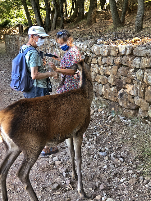
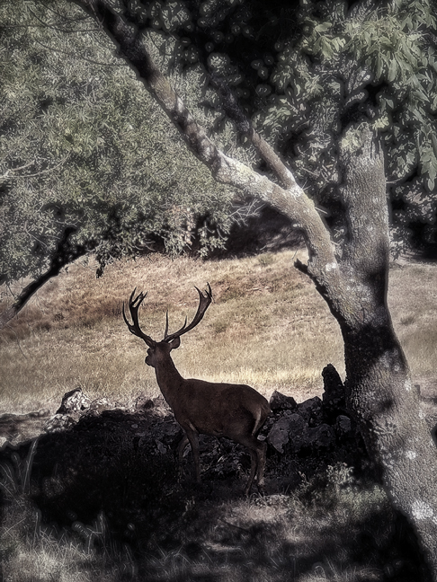
After exploring this ancient area, we returned to the priory, passing through its park grounds. There are a lot of animals living here, including deer that are perhaps a little too tame!

Next we visited the church and priory buildings. Around 1076, Étienne de Thiers founded a reform monastic community; after his death, several of his followers came to Grandmont and founded an abbey that became the mother abbey of the order, which was named for the plateau and became the Order of Grandmont.
Before it was an abbey, though, this land was used by the Visigoths, and there are Visigothic graves in the cemetery just beyond the apse of the church.
The original church buildings, dating to the 12th and 13th centuries, are completely preserved and are the only intact original buildings remaining from the Order of Grandmont. The order was quite strict: hermetic in nature, there was no conversation, no heat, and the monks were always barefoot.


Maryse had found a likely lunch spot: La Ginguette des Salces. Salces is a hamlet of the nearby village of Saint Privat. We enjoyed a delightful meal on a shady terrace that we shared with a jolly group of hunters, all wearing their brand-new orange sanglier (wild boar) T-shirts. Afterward, we strolled through the narrow streets of the hamlet, arriving at the 11th-century Église Notre-Dame-des-Salces. It’s a beauty.


The original reason for traveling to the Lodève area was to visit the art museum for their exhibit “Tisser la Nature” (Weaving Nature), showing tapestries representing nature and spanning six centuries. Our interest had already been piqued when we visited the Musée Dom Robert in Sorèze; his work was represented in this exhibit, too.


Monument aux Morts
As the sun began to sink and the light became more golden, we made our final stop of the day at the Monument aux Morts, the most unusual war memorial I’ve seen in France. The monument was installed in 1930, and the sculptor was Paul Dardé.

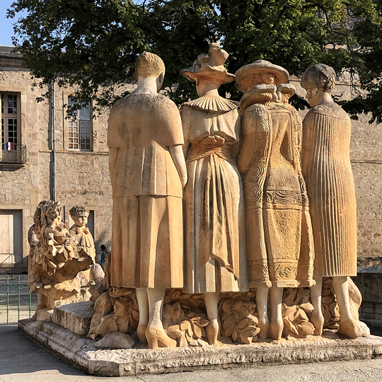
The monument was created to commemorate the lost lives of World War I, the war to end all wars. It shows a standing group of four women, plus one kneeling woman and two children, all surrounding the body of a dead soldier. The kneeling woman is likely the wife or mother of the soldier. The four standing women are dressed to show different social classes as well as the four seasons. The children, holding laurel leaves, represent innocence.
The sculptor, Dardé, was a stretcher-bearer during that war, and his brother was killed in the same war. He remained traumatized and anti-military for the rest of his life.
Parting shot
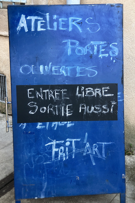
We were walking through Lodève toward the Monument aux Morts, when we happened upon this sign for open art studios. One gregarious artist was outside, and he encouraged us to step inside, where we browsed through several studios and found no treasures to take home. But the sign is funny.
